Échemiré
| Échemiré | ||
|---|---|---|
|
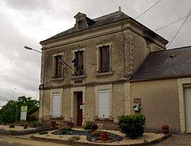
The town hall | ||
| ||
 Échemiré | ||
|
Location within Pays de la Loire region  Échemiré | ||
| Coordinates: 47°33′08″N 0°10′02″W / 47.5522°N 0.1672°WCoordinates: 47°33′08″N 0°10′02″W / 47.5522°N 0.1672°W | ||
| Country | France | |
| Region | Pays de la Loire | |
| Department | Maine-et-Loire | |
| Arrondissement | Saumur | |
| Canton | Baugé | |
| Intercommunality |
C.C. du Canton of Baugé Pays des Vallées d'Anjou | |
| Government | ||
| • Mayor (2008–2014) | Alain Chaslerie | |
| Area1 | 16.98 km2 (6.56 sq mi) | |
| Population (2006[1])2 | 577 | |
| • Density | 34/km2 (88/sq mi) | |
| Time zone | CET (UTC+1) | |
| • Summer (DST) | CEST (UTC+2) | |
| INSEE/Postal code | 49128 / 49150 | |
| Elevation |
33–101 m (108–331 ft) (avg. 63 m or 207 ft) | |
|
1 French Land Register data, which excludes lakes, ponds, glaciers > 1 km² (0.386 sq mi or 247 acres) and river estuaries. 2 Population without double counting: residents of multiple communes (e.g., students and military personnel) only counted once. | ||

Échemiré is a former commune in the Maine-et-Loire department in western France. On 1 January 2016, it was merged into the commune of Baugé-en-Anjou.[2] The inhabitants of the town of Échemiré are "Echemiréens, Echemiréennes"[3]
See also
References
| Wikimedia Commons has media related to Échemiré. |
This article is issued from Wikipedia - version of the 3/15/2016. The text is available under the Creative Commons Attribution/Share Alike but additional terms may apply for the media files.