1970 New Guinea earthquake
 Port Moresby | |
| Date | October 31, 1970 |
|---|---|
| Origin time | 17:53:14 UTC [1] |
| Magnitude | 6.9 Mw [1] |
| Depth | 60 km (37 mi) [1] |
| Epicenter | 5°00′S 145°24′E / 5°S 145.4°ECoordinates: 5°00′S 145°24′E / 5°S 145.4°E [1] |
| Areas affected | Papua New Guinea |
| Total damage | $1.75 million [2] |
| Max. intensity | VIII (Severe) [2] |
| Tsunami | 3 m (10 ft) [2] |
| Casualties |
5–18 deaths [2] 20 injured [2] |
The 1970 New Guinea earthquake struck the eponymous island and shocked the city of Madang on October 31. Causing between five and eighteen fatalities, it rocked the island and sent landslides cascading down steep hills into poorly reinforced wooden huts. The area that experienced the most powerful intensity extended 20 kilometers (12 mi) out from the epicenter. Underwater landslides caused minor tsunami over about 100 km of coast and severed underwater cables in several places.[3]
Geography and geology
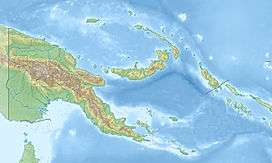
The earthquake took place near Madang, approximately 350 miles (563 km) northwest of Port Moresby. Generally, it was on the northeast coast.[4] The earthquake is thought to have been a result of strike-slip faulting in the area of complex structure along the boundary between the Pacific and Australian Plates.[5]
Damage and casualties
Up to eighteen deaths and twenty injuries occurred. Felt throughout the entire island of New Guinea, it caused extensive damage in the city of Madang, where it killed three people.[6] Several homes buckled and cracks appeared in streets.[7] On the coast of the island, a cable connecting telephone units for Australia and Guam was cut.[6] Initially, officials were worried of a tsunami risk though the earthquake did not produce any.[4] This was due to a dramatic recession of water levels near the epicenter, followed by a rise that at one point measured 3 meters (10 ft).[8] When a canoe was inverted by this change, three people were killed.[8]
Its maximum intensity of VIII (Severe) was restricted to a zone 20 kilometers (12 mi) from the epicenter (including the epicenter). Up to 70 kilometers (43 mi) away from the epicenter, damage measuring intensity VII (Very strong) was recorded. Landslides caused most of the deaths (which the Catalog of Tsunamis in the Pacific, 1969–1982 lists as 15), which occurred in wooden huts damaged by the shock and crushed by rock.[8] The number of huts damaged totaled more than 800.[8] The city most damaged was Madang. Houses with poor earthquake engineering such as those with weakly reinforced frames performed poorly. Forty-five percent of the city's steel water tanks were beyond repair.[8]
References
- 1 2 3 4 ISC (2015), ISC-GEM Global Instrumental Earthquake Catalogue (1900–2009), Version 2.0, International Seismological Centre
- 1 2 3 4 5 USGS (September 4, 2009), PAGER-CAT Earthquake Catalog, Version 2008_06.1, United States Geological Survey
- ↑ NGDC. "Comments for the Tsunami Event". Retrieved May 14, 2010.
- 1 2 "Strong Earthquake Hits New Guinea Coast Area". The Victoria Advocate. Victoria Advocate Publishing Co. November 1, 1970. Retrieved May 2, 2010.
- ↑ Borrero, J.C.; Bu J.; Saiang C.; Uslu B.; Freckman J.; Gomer B.; Okal E.A. & Synolakis C.E. (2003). "Field Survey and Preliminary Modeling of the Wewak, Papua New Guinea Earthquake and Tsunami of 9 September 2002" (PDF). Seismological Research Letters. 74 (4): 393–405. doi:10.1785/gssrl.74.4.393. ISSN 0895-0695. Retrieved May 14, 2010.
- 1 2 "Today in Earthquake History: October 31". December 18, 2009. Retrieved May 2, 2010.
- ↑ "Earthquake Jolts New Guinea". Milwaukee Journal Sentinel. Journal Communications. November 2, 1970. Retrieved May 2, 2010.
- 1 2 3 4 5 Soloviev, S. L.; Go, C. N.; Kim, K. (1992), Catalog of tsunamis in the Pacific 1969–1982 (PDF), Academy of Sciences of the USSR, p. 32