1994 Kuril Islands earthquake
 | |
| Date | October 4, 1994 at 13:23:00 UTC [1] |
|---|---|
| Magnitude |
8.3 Mw [1] 8.1 Mj [2] |
| Depth | 3 km (2 mi) [1] |
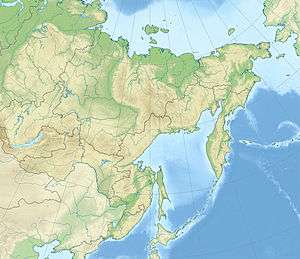
| Epicenter | 43°51′N 147°10′E / 43.85°N 147.17°ECoordinates: 43°51′N 147°10′E / 43.85°N 147.17°E [1] |
| Areas affected | Russia and Japan |
| Casualties |
10–12 dead 242–1,742 injured 1,200 homeless [3] |
The 1994 Kuril Islands earthquake occurred on October 5 at 00:23:00 local time. The magnitude of this earthquake was put at Mw 8.2, or Mj 8.1. The epicenter was located at about 70 km east of Shikotan Island. The shaking and tsunami caused road and building damage. At least 10 people were reported dead.
Earthquake
This earthquake was an intra-slab earthquake within the Pacific Plate which is subducting beneath the Okhotsk Plate.[4][5]
Damage
Oil storage tanks in Malokurilsk and Krabozavodsk were damaged. An oil leak occurred and causing heavy contamination of the port area.[6]
Intensity
The intensity was MSK VI~IX in Shikotan Island.[7]
The earthquake could be felt in Tokyo with shindo 3, and in Hokkaido, the highest intensity reached shindo 6.[8][9]
Aftershocks
A large aftershock of magnitude Mw 7.1 or Ms 7.7 occurred on October 9, 1994 at 07:55 UTC. It was located at 43.97° N, 148.22° E with a depth of 33 km.[7] It generated a tsunami, and a peak-to-trough tsunami wave height of 18 cm was recorded in Hanasaki, Japan.[10]
Tsunami
A numerical simulation of the tsunami suggested that the first wave was caused by a significant subsidence north of the Kuril Islands due to the earthquake.[11]
A peak-to-trough tsunami wave height of 346 cm was recorded in Hanasaki, Japan.[10]
This earthquake triggered a tsunami in southern Kuril Islands and Hokkaido.[12] The tsunami run-up height was more than 3 m in Yuzhno-Kurilsk bay and 5 m in Zelenyi Island, Russia.[7]
See also
References
- 1 2 3 4 ISC (2016), ISC-GEM Global Instrumental Earthquake Catalogue (1900–2009), Version 3.0, International Seismological Centre
- ↑ Cho, I.; Nakanishi, I.; Sato, T. (1999), "A feasibility test of CMT inversion using regional network of broad-band strong-motion seismographs for near-distance large earthquakes", Earth, Planets and Space, Springer Science+Business Media, 51: 247
- ↑ USGS (September 4, 2009), PAGER-CAT Earthquake Catalog, Version 2008_06.1, United States Geological Survey
- ↑ ftp://ftp.gps.caltech.edu/pub/avouac/Ge277-2007-fall/Tanioka_GRL1995.pdf
- ↑ http://www.iitk.ac.in/nicee/wcee/article/11_1599.PDF
- ↑ http://www.eeri.org/lfe/pdf/Japan_KurilIslands_Insert_Jan95.pdf
- 1 2 3 Melentyev, A. M.; Eisenberg, J. M. (1996). An engineering analysis of the consequences of the Shikotan earthquake of October 4(5), 1994 (PDF). Eleventh World Conference on Earthquake Engineering. Paper No. 1256. ISBN 0080428223.
- ↑ http://www.pari.go.jp/search-pdf/no0802.pdf p5
- ↑ http://ci.nii.ac.jp/naid/110006879701
- 1 2 http://earthquake.usgs.gov/earthquakes/eqarchives/significant/sig_1994.php
- ↑ "Generation of Tsunamis in the Okhotsk Sea Caused by the 1994 Great Kuril Earthquake" by Y. Tanioka
- ↑ http://www.sakhgu.ru/expert/Tsunami/Near.htm