Cape Romanzof Air Force Station
| Cape Romanzof Air Force Station Cape Romanzof Long Range Radar Site    | |
|---|---|
| Part of Eleventh Air Force (PACAF) | |
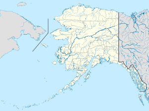
 Cape Romanzof AFS Location of Cape Romanzof AFS, Alaska | |
| Coordinates | 61°47′23″N 165°57′43″W / 61.78972°N 165.96194°W |
| Type | Air Force Station |
| Site information | |
| Controlled by |
|
| Site history | |
| Built | 1951 |
| In use | 1953-Present |
| Garrison information | |
| Garrison | 795th Aircraft Control and Warning Squadron (1953–1983) |
Cape Romanzof Air Force Station (AAC ID: F-06, LRR ID: A-10) is a closed United States Air Force General Surveillance Radar station. It is located 12.6 miles (20.3 km) west-southwest of Scammon Bay, Alaska.
The radar surveillance station was closed on 1 November 1983, and was redesignated as a Long Range Radar (LRR) site as part of the Alaska Radar System. Today, it remains active as part of the Alaska NORAD Region under the jurisdiction of the 611th Air Support Group, Elmendorf AFB, Alaska.
History
Cape Romanzof AFS was a continental defence radar station constructed to provide the United States Air Force early warning of an attack by the Soviet Union on Alaska.
Contracts were awarded during the spring of 1950, and work was started shortly afterwards on construction. The Army Transportation Corps undertook the project, code name Mona Lisa, of getting the initial supplies and equipment to the construction site. The only means of getting construction materials and supplies to the site was by barge or Navy LSTs, however this was restricted to when the sea was not frozen and had to be unloaded 15 miles from the proposed site. Initially, there were no roads, which had to be built as part of the construction effort. Each item had to be hauled along the beach 61°46′00″N 166°03′07″W / 61.76667°N 166.05194°W to the area nearest the construction site, then an additional five miles inland to the permanent storage area.
The station was opened in April 1953 as a general radar surveillance station, operated by the 795th Aircraft Control and Warning Squadron (AC&W Sq). The station had its main camp in a valley between peaks of the Azkinuk Mountains at the 1,500-foot level 61°47′06″N 165°57′10″W / 61.78500°N 165.95278°W, and a landing strip near sea level, 61°46′49″N 166°02′23″W / 61.78028°N 166.03972°W,2.6 miles (4.2 km) east-northeast. Recreational features included hobby shops and recreation rooms, plus opportunities for such sports as skiing, skating, horseshoes, and basketball. The buildings were connected by enclosed portals so no one needed to go outside in winter unless absolutely necessary. Tours at the station were limited to one year because of the psychological strain and physical hardships. Mail was usually delivered twice a week. The radars were located on a mountain peak at 2,300 feet.
The inaccessibility made the personnel at the site responsible for maintenance if anything went wrong. Water mains occasionally froze and ruptured. The station had a tramway connecting the base camp with the radars located on top of the mountain. The tramway cables were constantly breaking because of high winds and ice, and fog and the extreme cold made repairs hazardous. Ice 16 inches thick built up on the cables in winter.
Cape Romanzof provided information 24/7 to the air defense Direction Center at King Salmon AFS where it was analyzed to determine range, direction altitude speed and whether or not aircraft were friendly or hostile. Radars operated at the station were AN/FPS-3, AN/FPS-20A, AN/FPS-93 and an AN/FPS-87A.
Communications were initially provided by a high frequency radio system which proved unreliable because of atmospheric disturbances. The Alaskan Air Command, after investigating various options, decided to build the White Alice Communications System, a system of Air Force-owned tropospheric scatter and microwave radio relay sites operated by the Air Force Communications Service (AFCS). The Cape Romanzof site 61°46′51″N 165°57′09″W / 61.78083°N 165.95250°W was activated in 1957. It was inactivated in 1979, and replaced by an Alascom owned and operated satellite earth terminal as part of an Air Force plan to divest itself of the obsolete White Alice Communications System and transfer the responsibility to a commercial firm.
Over the years, the equipment at the station was upgraded or modified to improve the efficiency and accuracy of the information gathered by the radars. In 1983, Cape Romanzof received a new AN/FPS-117 minimally attended radar under Alaskan Air Command's SEEK IGLOO program . It was designed to transmit aircraft tracking data via satellite to the Alaskan NORAD Regional Operations Control Center (ROCC) at Elmendorf AFB.
No longer needed, the 795th AC&W Sq was inactivated on l November 1983 and the station re-designated as a Long Range Radar (LRR) Site. In 1990, jurisdiction of the Cape Romanzof LRR Site was transferred to Eleventh Air Force with the redesignation of AAC.
In 1998 Pacific Air Forces initiated "Operation Clean Sweep", in which abandoned Cold War stations in Alaska were remediated and the land restored to its previous state. After years of neglect the facilities at the station had lost any value they had when the site was closed. The site remediation of the radar, support and White Alice communication station was carried out by the 611th Civil Engineering Squadron at Elmendorf AFB, and remediation work was completed by 2005. Today very little of the former Cape Romanzof Air Force Station remains.
Current status
Today the site is controlled by the Pacific Air Forces 611th Air Support Group, based at Elmendorf AFB. The site is generally unattended; a few civilian contractors access the site by the Cape Romanzof LRRS Airport (ICAO: PACZ, TC LID: CCF) and provide maintenance and support when needed to maintain the radar system.
Air Force units and assignments

Units
- Constituted as the 795th Aircraft Control and Warning Squadron on 3 November 1952
- Activated on 8 December 1952
- Inactivated on 1 November 1983
Assignments
- 531st Aircraft Control and Warning Group 8 December 1952
- 10th Air Division, 13 April 1953
- 5039th Aircraft Control and Warning Group (later 5040th Aircraft Control and Warning Group), 1 June 1957
- 10th Air Division, 1 November 1959
- 5070th Air Defense Wing, 1 August 1960
- Alaskan Air Command, 1 October 1961
- 531st Aircraft Control and Warning Group (later 11th Tactical Control Group, 11th Tactical Control Wing), 2 December 1978 - 1 November 1983
See also
References
![]() This article incorporates public domain material from the Air Force Historical Research Agency website http://www.afhra.af.mil/.
This article incorporates public domain material from the Air Force Historical Research Agency website http://www.afhra.af.mil/.