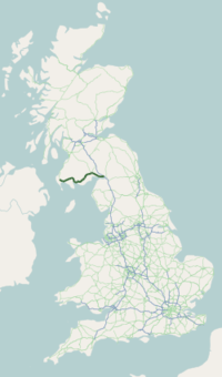
A75 road
| |
|---|---|
 | |
|
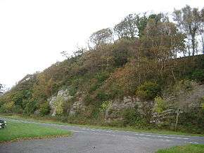
Barholm Wood, between Castle Douglas and Newton Stewart | |
| Route information | |
|
Part of | |
| Length: | 95.4 mi[1] (153.5 km) |
| Existed: | 1923 – present |
| Major junctions | |
| East end: | Gretna |
|
J22 → A74(M) motorway | |
| West end: | Stranraer |
| Location | |
| Primary destinations: | Carlisle, Gretna, Dumfries, Stranraer |
| Road network | |

The A75 is a Primary Trunk Road in Scotland, linking Stranraer and its ferry ports at Cairnryan with the A74(M) at Gretna, close to the Border with England and the M6 Motorway.
Route
Heading west along the south coast of Scotland from its junction with the A74(M) motorway at Gretna it continues past Eastriggs, Annan, Dumfries, Castle Douglas, Gatehouse of Fleet, Newton Stewart, Kirkcowan and Glenluce before ending at Stranraer.
The majority of the road is of single-carriageway standard, although a few short dual carriageway sections exist, including a one-mile section past Gretna, a section past Collin (just east of Dumfries,) a two-mile section just west of Dumfries and a 1-mile section at Barlae (Between Glenluce and Newton Stewart.)
There are also numerous 3 lane, Overtaking sections which allow overtaking in one direction or on some occasion both directions. The road is currently being re-routed at Carrutherstown (near Dumfries) and a bypass has been constructed to avoid the village of Dunragit and the frequently struck Challoch Railway Bridge, which has earned the title of "most hit bridge in the UK[2] ".
There are only two service stations on the A75: one at Collin on the eastern edge of Dumfries, and one at Castle Kennedy to the east of Stranraer.
The road forms part of the international E-road, European route E18.
The majority of Heavy Goods Vehicles which cross the short sea route of the North Channel via Cairnryan utilise the A75, with a much as 90% of HGV Traffic using the A75.[3]
History
The single-carriageway road has been upgraded to a very high standard in recognition of the heavy freight traffic it carries between the A74(M)/M6 and the ferry ports for Northern Ireland at Cairnryan, and only two settlements are now not bypassed by it (at Springholm and Crocketford, both lying around 10 miles west of Dumfries).
The 1.3 mile stretch of dual carriageway and associated one-mile westbound overtaking lane one-mile west of Dumfries opened in 1999, which replaced the previous bottleneck road which snaked up a wooded glen and afforded no overtaking opportunity by way of solid double white lines for its duration, locally known as The Glen.[4] The new section claimed the title after the previous road was declassified and closed at the western end, allowing only local access to residential property and agricultural land.
Transport Scotland has six projects which were announced in 2008 to improve stretches of the A75, two of these projects (Dunragit Bypass & Hardgrove Project) are still under construction, with the remainder completed.[5]
- Barfil to Bettyknowes Project - westbound overtaking opportunity over a length of 875metres and re-alignment.
- Cairntop to Barlae Project - eastbound overtaking opportunity of 2.5 kilometres, utilising the line of a disused railway line.
- Dunragit Bypass Project - bypass of the village of Dunragit, to the east of Stranraer, through which the A75 runs at present.
- Hardgrove Project - the construction of a new 3.6 kilometre stretch of the A75, between Carrutherstown and Upper Mains Farm in Dumfries and Galloway, providing improved overtaking facilities in both the east and westbound directions.
- Newton Stewart DAL Project - westbound overtaking opportunity over a length of 375 metres.
- Planting End to Drumflower Project - eastbound overtaking opportunity over a length of 1 kilometre
Previously the road ran between Dumfries & Gretna further south than its current locale, The previous road which is identified locally as the "low road" can be recognised from the B721 and B724 roads. A large majority of the remaining road previously ran through towns & settlements which have been bypassed over time, large sections of the A75 have been straightened, bypassed and re-aligned, with the majority still visible as minor roads and easily identifiable by studying Ordnance Survey maps of the area. One of the earliest bypasses on the route is that of Kirkcowan, which is believed to be the first village, town or settlement to have been bypassed by the original A75.
Dangers
It is also classed as one of the most dangerous roads in Scotland.
Haunted history
A fifteen-mile stretch of the A75, between Annan and Dumfries, known as the Kinmount Straight, between Carrutherstown and Annan, is reported to be haunted.[6] The area near Kelhead Plantation (an effective avenue of trees), near Kinmount House, is a main site of the mysterious events. Sightings have been seen near the Swordwellrigg hamlet on the Annan bypass.
Reports of haunting
1962
Derek and Norman Ferguson were driving along the A75 near Kinmount, around midnight, when a large hen flew towards their window screen, but vanished on the point of impact. The hen was followed by an old lady who ran towards the car waving her outstretched arms. She was followed by a screaming man with long hair and further animals, including 'great cats, wild dogs, goats, more hens and other fowl, and stranger creatures', who all disappeared. The temperature then dropped, and when the brothers stopped the car, it began to sway violently back and forth. Derek got out of the car and the movement stopped. He climbed back in and then, finally, a vision of a furniture van came towards them before disappearing.[7]
The Port Road railway line
The Port Road to Stranraer being the last to go in June 1965 under the notorious Beeching Axe leaving only the original G&SWR main line open to serve the Stranraer. The Beeching Axe cutting the Castle Douglas and Dumfries Railway and Portpatrick and Wigtownshire Railway has resulted in adverse mileage to connect Stranraer with a longer line via Kilmarnock and Ayr.
The Port Road provided the most direct line from London Euston railway station and the West Coast Main Line to Stranraer Harbour railway station for the ferries to Larne Harbour railway station and the Port of Belfast.
References
- ↑ "Driving directions to A75". Google. Retrieved 23 September 2013.
- ↑ "Challoch is 'most hit' bridge in UK". The Galloway Gazette. 2010-08-05. Retrieved 2014-03-21.
- ↑ http://www.south-ayrshire.gov.uk/roads/publications/a77%20maybole%20100305.pdf
- ↑ "McLeish announces award of £7 million package of improvements to A75 at the Glen". Scotland.gov.uk. 1998-03-23. Retrieved 2014-03-21.
- ↑ Road Projects Search Results A75
- ↑ Mysterious Britain
- ↑ Cohen, Daniel; Marchesi, Stephen (1992). "The Annan Road Horrors". Railway Ghosts and Highway Horrors. London: Apple. pp. 61–66. ISBN 0-590-45423-4.
External links
A roads in Zone 7 of the Great Britain road numbering scheme | ||
|---|---|---|
Coordinates: 54°57′38″N 3°54′50″W / 54.96042°N 3.91388°W