Aagaard Glacier
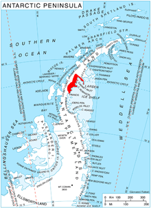
Aagaard Glacier (66°46′S 64°31′W / 66.767°S 64.517°WCoordinates: 66°46′S 64°31′W / 66.767°S 64.517°W), also known as Glaciar Alderete, is a 8-mile (13 km) long Antarctic glacier which lies close to the east of Gould Glacier and flows in a southerly direction into Mill Inlet, on the east coast of Graham Land. It was charted by the Falkland Islands Dependencies Survey (FIDS) and photographed from the air by the Ronne Antarctic Research Expedition during December 1947; it was named by the FIDS for Bjarne Aagaard, a Norwegian authority on Antarctic whaling and exploration.
See also
![]() This article incorporates public domain material from the United States Geological Survey document "Aagaard Glacier" (content from the Geographic Names Information System).
This article incorporates public domain material from the United States Geological Survey document "Aagaard Glacier" (content from the Geographic Names Information System).