Acapetahua
| Acapetahua | |
|---|---|
| Municipality | |
 Municipality of Acapetahua in Chiapas | |
|
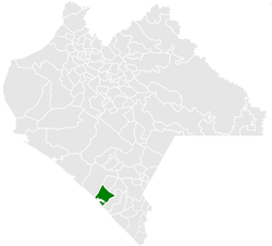
Acapetahua Location in Mexico | |
| Coordinates: 15°17′N 92°41′W / 15.283°N 92.683°WCoordinates: 15°17′N 92°41′W / 15.283°N 92.683°W | |
| Country |
|
| State | Chiapas |
| Area | |
| • Total | 73.9 sq mi (191.3 km2) |
| Population (2010) | |
| • Total | 27,580 |
Acapetahua is a town and one of the 122 Municipalities of Chiapas, in southern Mexico. As of 2010, the municipality had a total population of 27,580,[1] up from 14,189 in 2005.[2]
As of 2010, the town of Acapetahua had a population of 6,194.[1] Other than the town of Acapetahua, the municipality had 272 localities, the largest of which (with 2010 populations in parentheses) were: Soconusco (2,502), classified as urban, and Consuelo Ulapa (1,937), El Arenal (1,157), and Jiquilpan (Estación Bonanza) (1,119), classified as rural.[1]
History
The precise date that the town was founded is unknown. However, it existed well before the Spanish conquered the continent. In 1524, Pedro de Alvarado conquered the region known as Soconusco, In 1526 the region formed part of the Spanish colonization and in 1529 was annexed to México. In 1774 it was formed as part of the town of Escuintla. In 1861, it had more than 100 inhabitants. On November 10, 1947, César A. Lara, governor of the state, declared it an official municipality.
Economy
The municipality is known for its avocado production.
References
- 1 2 3 "Acapetahua". Catálogo de Localidades. Secretaría de Desarrollo Social (SEDESOL). Retrieved 23 April 2014.
- ↑ "Principales resultados por localidad 2005 (ITER)". INEGI. Retrieved July 23, 2008.
