Achnafauld
| Achnafauld | |
| Scottish Gaelic: Achadh na Follt | |
 Achnafauld |
|
| OS grid reference | NN875363 |
|---|---|
| Council area | Perth and Kinross |
| Country | Scotland |
| Sovereign state | United Kingdom |
| Post town | ABERFELDY |
| Postcode district | PH15 |
| Dialling code | 01887 |
| Police | Scottish |
| Fire | Scottish |
| Ambulance | Scottish |
| EU Parliament | Scotland |
Coordinates: 56°30′19″N 3°49′46″W / 56.505271°N 3.829403°W
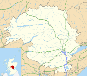
Achnafauld (Scottish Gaelic: Achadh na Follt) is a settlement in the Scottish Highlands, about 15 miles northwest of Perth.[1] It is located in the parish of Dull in the council area of Perth and Kinross.[2]
-

Achnafauld
-

The Achnafauld Burn
References
- ↑ "Pitlochry and Crieff", Ordnance Survey Landranger Map (B2 ed.), 2008, ISBN 0-319-22985-8
- ↑ Scottish-places.info
| Wikimedia Commons has media related to Achnafauld. |
This article is issued from Wikipedia - version of the 9/16/2015. The text is available under the Creative Commons Attribution/Share Alike but additional terms may apply for the media files.