Adamawa Plateau
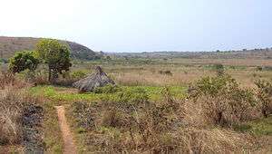
The Adamawa Plateau (French: Massif de l'Adamaoua) is a plateau region in west-central Africa stretching from south-eastern Nigeria through north-central Cameroon (Adamawa and North Provinces) to the Central African Republic.[1] The plateau was named after Fulani Muslim leader Modibo Adama.[2] The part of the plateau that lies in Nigeria is more popularly known as Gotel Mountains. The Adamawa Plateau is the source of many waterways, including the Benue River. It is important for its deposits of bauxite.[1] The average elevation is about 3,300 feet (1,000 meters),[2] but elevations can reach as high as 8,700 feet (2,650 meters).[1] The vegetation is mostly savanna, and is sparsely populated. Cattle raising is the main occupation in the area.[2]
The endangered toad Amietophrynus djohongensis is only known from the Adamawa Plateau in Cameroon.[3][4]
References
- 1 2 3 "Encyclopædia Britannica - Adamawa Plateau". Archived from the original on 15 October 2007. Retrieved September 15, 2007.
- 1 2 3 "MSN Encarta - Adamawa Plateau". Archived from the original on 2009-10-31. Retrieved September 15, 2007.
- ↑ Joger, U., Tandy, M. & Amiet, J.-L. (2004). "Amietophrynus djohongensis". IUCN Red List of Threatened Species. IUCN. 2004: e.T54630A11178521. doi:10.2305/IUCN.UK.2004.RLTS.T54630A11178521.en.
- ↑ Frost, Darrel R. (2015). "Amietophrynus djohongensis (Hulselmans, 1977)". Amphibian Species of the World: an Online Reference. Version 6.0. American Museum of Natural History. Retrieved 23 October 2015.
Coordinates: 9°48′N 14°05′E / 9.800°N 14.083°E