Administrative divisions of Namibia
 |
| This article is part of a series on the politics and government of Namibia |
Namibia is divided into 14 regions and subdivided into 121 constituencies. The administrative divisions of Namibia are tabled by Delimitation Commissions and accepted or declined by the National Assembly.
History
Before the independence of Namibia the territory was known as South-West Africa (before 1885 and between 1915 and 1989) and as German South-West Africa during the time of colonialisation by the German Empire (1885-1915).
During the South African administration it was considered the de facto fifth province of South Africa, although a formal request for annexation to the United Nations was turned down.[1] The territory that became the independent state of Namibia on 21 March 1990 inherited the administrative division of this "province" which consisted of 26 districts. These districts remained until the First Delimitation Commission of Namibia tabled its recommendations in the National Assembly, and the latter approved and implemented them in 1992. Since then, Namibia is divided into regions which in turn are divided into constituencies.[2]
Delimitation Commissions
Delimitation Commissions are three-member bodies appointed by the president that make suggestions as to how Namibia should be administratively divided, considering only geographical changes like population grow and migration but not discriminating by ethnic factors. They are mentioned in articles 102-104 of the constitution, and they are to sit approximately once every ten years,[3] although they sat more frequently before 2002.
The chairman of the Delimitation Commission must be a judge at either a High Court or the Supreme Court. This judge and the other two commission members are appointed by the president, subject to the approval of Parliament.[3]
The four Delimitation Commissions of Namibia so far are:[2]
| Commission | Formed | Members | Decisions |
|---|---|---|---|
| 1st | 1990 | Judge President Johan Strydom Martin Shipanga Professor Gerhard Tötemeyer |
|
| 2nd | 1998 | Judge JP Karuaihe Dr Samuel Mbambo Professor Lazarus Hangula |
|
| 3rd | 2002 | Judge Peter Shivute Inge Murangi Peter Kauluma |
|
| 4th | 2013 | Judge Alfred Siboleka Dr Zedekia Ngavirue Dr Jonathan Steytler |
|
Current administrative division
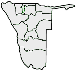
The current administrative division of Namibia is the result of the work of the Fourth Delimitation Commission, tabled in 2013. Namibia is divided into 14 regions and 121 constituencies.[4]
References
- ↑ "Namibia: Apartheid, resistance and repression (1945-1966)". Electoral Institute for the Sustainability of Democracy in Africa. August 2009. Retrieved 15 April 2011.
- 1 2 "Composition of the Delimitation Commissions and the major decisions made from 1990 to present". Election Watch. Institute for Public Policy Research (1): 2. 2013.
- 1 2 "Delimitation Underway". Election Watch. Institute for Public Policy Research (1): 1. 2013.
- 1 2 Nakale, Albertina (9 August 2013). "President divides Kavango into two". New Era. allafrica.com.