Aipe
| AIPE | ||
|---|---|---|
| Municipality and town | ||
| ||
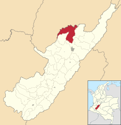 Location of the municipality and town of Aipe in the Huila Department of Colombia. | ||
| Coordinates: 3°13′N 75°14′W / 3.217°N 75.233°W | ||
| Country |
| |
| Department | Huila Department | |
| Region | Andean Region of Colombia | |
| Founded | 1872 [1] | |
| Government | ||
| • Mayor | Lasso Luis Felipe Conde | |
| Area | ||
| • Total | 801.04 km2 (309.28 sq mi) | |
| Population (2005 [2]) | ||
| • Total | 19,928 | |
| • Density | 24.8/km2 (64/sq mi) | |
| Time zone | Colombia Standard Time (UTC-5) | |
| Website | www.aipe-huila.gov.co | |

Aipe is a town and municipality in the Huila Department, Colombia.
History
In early 1741, Dona Teresa and Don Enrique Cortes, descendants of Mr. Jacinto Cortés, gave 80 hectares to establish a new town, and are considered the founders of the Municipality of Aipe. In 1770, the church hierarchy and government in Neiva records the construction of the church of Our Lady of Sorrows.
In 1874 Aipe acquired autonomy from Neiva, as a member of the canton district of Villavieja and on 8 April 1912 by Ordinance No. 26, was created as a municipality by the Departmental Assembly.
Geography
The Municipality of Aipe is located on the left bank of the Magdalena River. It is located northwest of the Department of Huila, in the Magdalena Valley, bounded on the north and west by the Department of Tolima to the east the Magdalena River, and south by the municipality of Neiva.
The municipality has a total area of 801.04 km2 (3.8% total of the department). The lowest level of the municipality is located at the mouth of the Magdalena River a height of 350 meters above sea level, with average annual temperature of 28.4° C. The highest point is 2,300 meters above sea level, located in the La Union (west of the municipale boundary with the Department of Tolima), with an average temperature of 13.67° C.
References
- ↑ Alcaldía de Acevedo (Huila) (ed.). "Información general de Aipe" (in Spanish). Retrieved 22 July 2009.
- ↑ "Censo 2005 (Aipe)" (pdf) (in Spanish). DANE. Retrieved 22 July 2009.
Coordinates: 3°13′N 75°14′W / 3.217°N 75.233°W