Chana District
| Chana จะนะ | |
|---|---|
| Amphoe | |
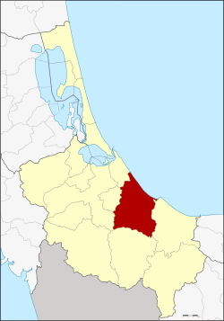 Amphoe location in Songkhla Province | |
| Coordinates: 6°54′51″N 100°44′26″E / 6.91417°N 100.74056°ECoordinates: 6°54′51″N 100°44′26″E / 6.91417°N 100.74056°E | |
| Country |
|
| Province | Songkhla |
| Seat | Ban Na |
| Tambon | 14 |
| Muban | 139 |
| Area | |
| • Total | 502.98 km2 (194.20 sq mi) |
| Population (2014) | |
| • Total | 104,162 |
| • Density | 193.0/km2 (500/sq mi) |
| Time zone | THA (UTC+7) |
| Postal code | 90130 |
| Geocode | 9003 |
Chana (Thai: จะนะ, Pattani Malay: จือเนาะ, Malay: Chenok) is a district (Amphoe) in the southeastern part of Songkhla Province, southern Thailand.
Geography
Neighboring districts are (from the east clockwise) Thepha, Na Thawi, Sadao, Hat Yai, Na Mom and Mueang Songkhla of Songkhla Province. To the northeast is the Gulf of Thailand.
History
Originally, Chana together with Palian, Thepha and Songkhla was one of four Mueang subordinate under the Mueang Phatthalung. When Songkhla was split off from Phatthalung and made a direct subordinate of Bangkok, Chana was then placed under Songkhla.
The location of the town was moved several times, so when it was made a district in the thesaphiban administrative reforms at the beginning of the 20th century the district office was located in present-day Na Thawi. However, as the location turned out to be inconvenient it was moved to Ban Na. In 1917 the district was thus renamed to Ban Na after the central tambon,[1] in 1924 the name was changed back to Chana by the government to avoid confusion with the district Ban Na in Surat Thani province and Ban Na in Nakhon Nayok province.[2]
Etymology
The name Chana is actually the Thai corruption of Chenok, its original name in Malay.
Administration
Central administration
The district Chana is subdivided into 14 subdistricts (Tambon), which are further subdivided into 139 administrative villages (Muban).
| No. | Name | Thai | Villages | Pop.[3] |
|---|---|---|---|---|
| 1. | Ban Na | บ้านนา | 10 | 16,150 |
| 2. | Pa Ching | ป่าชิง | 9 | 4,911 |
| 3. | Saphan Mai Kaen | สะพานไม้แก่น | 8 | 6,598 |
| 4. | Sakom | สะกอม | 9 | 8,362 |
| 5. | Na Wa | นาหว้า | 12 | 7,655 |
| 6. | Na Thap | นาทับ | 14 | 12,977 |
| 7. | Nam Khao | น้ำขาว | 11 | 3,872 |
| 8. | Khun Tat Wai | ขุนตัดหวาย | 9 | 3,097 |
| 9. | Tha Mo Sai | ท่าหมอไทร | 11 | 6,620 |
| 10. | Chanong | จะโหนง | 11 | 7,661 |
| 11. | Khu | คู | 9 | 6,411 |
| 12. | Khae | แค | 7 | 4,323 |
| 13. | Khlong Pia | คลองเปียะ | 11 | 5,478 |
| 14. | Taling Chan | ตลิ่งชัน | 8 | 10,047 |
Local administration
There are 3 subdistrict municipalities (Thesaban Tambon) in the district:
- Chana (Thai: เทศบาลตำบลจะนะ) consisting of parts of the subdistrict Ban Na.
- Ban Na (Thai: เทศบาลตำบลบ้านนา) consisting of parts of the subdistrict Ban Na.
- Na Thap (Thai: เทศบาลตำบลนาทับ) consisting of the complete subdistrict Na Thap.
There are 12 subdistrict administrative organizations (SAO) in the district:
- Pa Ching (Thai: องค์การบริหารส่วนตำบลป่าชิง) consisting of the complete subdistrict Pa Ching.
- Saphan Mai Kaen (Thai: องค์การบริหารส่วนตำบลสะพานไม้แก่น) consisting of the complete subdistrict Saphan Mai Kaen.
- Sakom (Thai: องค์การบริหารส่วนตำบลสะกอม) consisting of the complete subdistrict Sakom.
- Na Wa (Thai: องค์การบริหารส่วนตำบลนาหว้า) consisting of the complete subdistrict Na Wa.
- Nam Khao (Thai: องค์การบริหารส่วนตำบลน้ำขาว) consisting of the complete subdistrict Nam Khao.
- Khun Tat Wai (Thai: องค์การบริหารส่วนตำบลขุนตัดหวาย) consisting of the complete subdistrict Khun Tat Wai.
- Tha Mo Sai (Thai: องค์การบริหารส่วนตำบลท่าหมอไทร) consisting of the complete subdistrict Tha Mo Sai.
- Chanong (Thai: องค์การบริหารส่วนตำบลจะโหนง) consisting of the complete subdistrict Chanong.
- Khu (Thai: องค์การบริหารส่วนตำบลคู) consisting of the complete subdistrict Khu.
- Khae (Thai: องค์การบริหารส่วนตำบลแค) consisting of the complete subdistrict Khae.
- Khlong Pia (Thai: องค์การบริหารส่วนตำบลคลองเปียะ) consisting of the complete subdistrict Khlong Pia.
- Taling Chan (Thai: องค์การบริหารส่วนตำบลตลิ่งชัน) consisting of the complete subdistrict Taling Chan.
References
- ↑ ประกาศกระทรวงมหาดไทย เรื่อง เปลี่ยนชื่ออำเภอ (PDF). Royal Gazette (in Thai). 34 (0 ก): 40–68. 1917-04-29.
- ↑ ประกาศเปลี่ยนนามอำเภอบ้านนาในมณฑลนครศรีธรรมราช (PDF). Royal Gazette (in Thai). 41 (ง): 539. June 1, 1924.
- ↑ "Population statistics 2014" (in Thai). Department of Provincial Administration. Retrieved 2015-05-24.
External links
- amphoe.com
- http://www.chana-sk.go.th Website of district (Thai)