Si Prachan District
| Si Prachan ศรีประจันต์ | |
|---|---|
| Amphoe | |
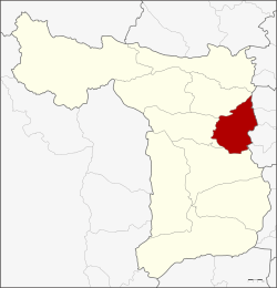 Amphoe location in Suphanburi Province | |
| Coordinates: 14°37′11″N 100°8′40″E / 14.61972°N 100.14444°ECoordinates: 14°37′11″N 100°8′40″E / 14.61972°N 100.14444°E | |
| Country |
|
| Province | Suphanburi |
| Tambon | 9 |
| Muban | 64 |
| Area | |
| • Total | 181.0 km2 (69.9 sq mi) |
| Population (2013) | |
| • Total | 62,419 |
| • Density | 359.1/km2 (930/sq mi) |
| Time zone | THA (UTC+7) |
| Postal code | 72140 |
| Geocode | 7205 |
Si Prachan (Thai: ศรีประจันต์; IPA: [sǐː prā.tɕān]) is a district (Amphoe) in the eastern part of Suphanburi Province, central Thailand.
History
The government separated some part of Tha Phi Liang district (now Mueang Suphanburi) and Nang Buat district to create the Si Prachan district in 1901.
Geography
Neighboring districts are (from the south clockwise) Mueang Suphanburi, Don Chedi and Sam Chuk, and Sawaeng Ha, Pho Thong, Samko and Wiset Chai Chan of Ang Thong Province.
The main water resource of the district is the Tha Chin river or Suphan river.
Administration
Central administration
The district Si Prachan is subdivided into 9 subdistrict (Tambon), which are further subdivided into 64 administrative villages (Muban).
| No. | Name | Thai | Villages | Pop.[1] |
|---|---|---|---|---|
| 1. | Si Prachan | ศรีประจันต์ | 6 | 8,607 |
| 2. | Ban Krang | บ้านกร่าง | 6 | 8,334 |
| 3. | Mot Daeng | มดแดง | 7 | 5,412 |
| 4. | Bang Ngam | บางงาม | 6 | 3,382 |
| 5. | Don Pru | ดอนปรู | 9 | 9,210 |
| 6. | Plai Na | ปลายนา | 7 | 8,329 |
| 7. | Wang Wa | วังหว้า | 7 | 5,382 |
| 8. | Wang Nam Sap | วังน้ำซับ | 7 | 6,761 |
| 9. | Wang Yang | วังยาง | 9 | 7,002 |
Local administration
There are 6 subdistrict municipalities (Thesaban Tambon) in the district:
- Ban Krang (Thai: เทศบาลตำบลบ้านกร่าง) consisting of parts of the subdistrict Ban Krang.
- Wang Wa (Thai: เทศบาลตำบลวังหว้า) consisting of the complete subdistrict Wang Wa.
- Wang Nam Sap (Thai: เทศบาลตำบลวังน้ำซับ) consisting of the complete subdistrict Wang Nam Sap.
- Si Prachan (Thai: เทศบาลตำบลศรีประจันต์) consisting of parts of the subdistricts Si Prachan, Ban Krang.
- Wang Yang (Thai: เทศบาลตำบลวังยาง) consisting of the complete subdistrict Wang Yang.
- Plai Na (Thai: เทศบาลตำบลปลายนา) consisting of the complete subdistrict Plai Na.
There are 4 subdistrict administrative organizations (SAO) in the district:
- Si Prachan (Thai: องค์การบริหารส่วนตำบลศรีประจันต์) consisting of parts of the subdistrict Si Prachan.
- Mot Daeng (Thai: องค์การบริหารส่วนตำบลมดแดง) consisting of the complete subdistrict Mot Daeng.
- Bang Ngam (Thai: องค์การบริหารส่วนตำบลบางงาม) consisting of the complete subdistrict Bang Ngam.
- Don Pru (Thai: องค์การบริหารส่วนตำบลดอนปรู) consisting of the complete subdistrict Don Pru.
References
- ↑ "Population statistics 2013" (in Thai). Department of Provincial Administration. Retrieved 2014-10-04.