Andringitra National Park
| Andringitra National Park | |
|---|---|
|
IUCN category II (national park) | |
 | |
 | |
| Location | Southeastern Madagascar |
| Nearest city | Ambalavao |
| Coordinates | 22°6′46″S 46°55′23″E / 22.11278°S 46.92306°ECoordinates: 22°6′46″S 46°55′23″E / 22.11278°S 46.92306°E |
| Area | 31,160 km2 (12,031 sq mi) |
| Established | 1999 |
| Governing body | Madagascar National Parks Association (PNM-ANGAP) |
Andringitra National Park is a national park in the Haute Matsiatra region of Madagascar, 47 kilometres (29 mi) south of Ambalavao. The park was established in 1969 and is managed by the Madagascar National Parks Association. It was inscribed in the World Heritage Site in 2007 as part of the Rainforests of the Atsinanana.
History
The importance of the area was noted by explorers in the early 20th century and in 1927 the central part of the mountain range was declared a ″Strict Nature Reserve″. During the early 1990s the Malagasy Environmental Action Plan introduced the idea of Madagascar taking ownership of the environmental agenda, rather than donors, and in 1999 the area became a National Park.[1][2] In 2007 the park became part of the Rainforests of the Atsinanana World Heritage Site.[3]
Geography
The reserve covers 31,160 hectares (77,000 acres) covering much of the granite massif of the Andringitra mountains which rise above plains. The altitude of the reserve varies from 700 metres (2,300 ft) to the peak of the second highest mountain in the country, Imarivolanitra (formerly Pic Boby) at 2,658 metres (8,720 ft).[4] The mean annual rainfall is 1,500–2,500 millimetres (59–98 in) and snowfall occurs in some years. Madagascar's lowest temperature, −8 °C (18 °F) has been recorded here.[4][5] The Ampanasana, Iantara, Menarahaka and Zomandao rivers run through the reserve.
Three different groups of people live within the park. In the south and west the Bara people graze cattle on the savannah and in the valleys and on the ridges, while in the east the Bara Haronga grow rice, and the Betsileo people have developed an irrigation system on the mountain flanks of the north for rice cultivation.[4]
Flora and fauna
The park is one of the most biologically diverse places in Madagascar, with many endemic species. The eastern flank of the massif is covered with humid forest, and humid grassland and scrub in the higher areas. On the western flank there is relatively dry forest. There are over one thousand species of plants, one hundred species of birds, and fifty-five species of frogs are known to inhabit the park.[2]
There are over fifty species of mammals, including thirteen species of lemur. Andringitra's ring-tailed lemur population has notably thicker fur than the rest of the island's population. This is likely an adaptation to the colder climate at high altitudes.[6]
| Viewing time | Species |
|---|---|
| Daytime |
|
| Nighttime |
|
See also
| Wikimedia Commons has media related to Andringitra National Park. |
References
- ↑ Razafindralambo, Guy; Gaylord, Lisa. "Madagascar: National Environmental Action Plan". pp. 75–82. Retrieved 30 October 2016.
- 1 2 "Andringitra National Park". Travel Madagascar. Retrieved 30 October 2016.
- ↑ "Nomination of natural, mixed and cultural properties to the world heritage list – Rainforests of the Atsinanana". UNESCO World Heritage. Retrieved 30 October 2016.
- 1 2 3 "Andringitra National Park". Madagaskar.com. Retrieved 30 October 2016.
- ↑ Preston-Mafham, Ken (1991). Madagascar: A Natural History. Oxford: Facts On File. pp. 211–2. ISBN 0 8160 2403 0.
- ↑ Mittermeier, R.A.; Louis, E.E.; Richardson, M.; Schwitzer, C.; et al. (2010). Lemurs of Madagascar. Illustrated by S.D. Nash (3rd ed.). Conservation International. p. 634. ISBN 978-1-934151-23-5. OCLC 670545286.
External links
- Official Website
- A tent camp close to the entrance of Andringitra park
- Photos within and around Andrigitra park
- Details from FAO Corporate Document Repository
| Strict Nature Reserves | 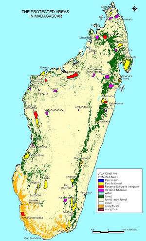 | |
|---|---|---|
| National parks | ||
| Wildlife Reserves | ||