Anglin
For other uses, see Anglin (disambiguation).
| Anglin | |
|---|---|
 The Anglin | |
| Country | France |
| Basin | |
| Main source |
near Azerables 300 m (980 ft) 46°21′36″N 01°28′30″E / 46.36000°N 1.47500°E |
| River mouth |
Gartempe 62 m (203 ft) 46°42′15″N 01°51′57″E / 46.70417°N 1.86583°ECoordinates: 46°42′15″N 01°51′57″E / 46.70417°N 1.86583°E |
| Progression | Gartempe→ Creuse→ Vienne→ Loire→ Atlantic Ocean |
| Basin size | 1,660 km2 (640 sq mi) |
| Physical characteristics | |
| Length | 91 km (57 mi) |
| Discharge |
|
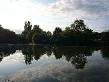
The Anglin is a 91 km (57 mi) long river in the Creuse, Indre and Vienne départements in central France. Its source is near Azerables. It flows generally northwest. It is a right tributary of the Gartempe into which it flows near Angles-sur-l'Anglin.
Its main tributaries are the Salleron, the Abloux and the Benaize.
The Anglin is one of France's few remaining "wild rivers" (rivers which have never been dammed). Anglin Castle is an 11th Century castle located high above the banks of the Anglin River in the town of Angles-sur-l'Anglin.
Départements and communes along its course
The following list is ordered from source to mouth :
- Creuse: Azerables
- Indre: Mouhet, La Châtre-Langlin, Chaillac, Dunet, Lignac, Chalais, Bélâbre, Mauvières, Saint-Hilaire-sur-Benaize, Concremiers, Ingrandes, Mérigny
- Vienne: Saint-Pierre-de-Maillé, Angles-sur-l'Anglin
Notes
- This article is based on the equivalent article from the French Wikipedia, consulted on February 24, 2009.
References
| Wikimedia Commons has media related to Anglin. |
This article is issued from Wikipedia - version of the 7/8/2016. The text is available under the Creative Commons Attribution/Share Alike but additional terms may apply for the media files.