Anstruther Lake
| Anstruther Lake | |
| Lake | |
| Country | Canada |
|---|---|
| Province | Ontario |
| County | Peterborough |
| Municipality | North Kawartha |
| Part of | Great Lakes Basin |
| Tributaries | |
| - left | Camp Creek (Southern Ontario) |
| - right | Anstruther Creek |
| City | Anstruther Lake |
| Elevation | 299 m (981 ft) |
| Coordinates | 44°44′36″N 78°12′28″W / 44.74333°N 78.20778°WCoordinates: 44°44′36″N 78°12′28″W / 44.74333°N 78.20778°W |
| Mouth | Anstruther Creek |
| Length | 6 km (4 mi) |
| Width | 3 km (2 mi) |
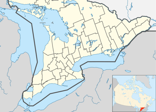 Location of Anstruther Lake in southern Ontario.
| |
Anstruther Lake is a lake in the township of North Kawartha, Peterborough County, Ontario, Canada, between the community of Apsley on Ontario Highway 28 8.5 kilometres (5.3 mi) to the east and the community of Catchacoma on Ontario Highway 507 8.5 kilometres (5.3 mi) to the west. Kawartha Highlands Provincial Park encompasses the lake, and the community of Anstruther Lake is on the southern shore. The lake flows out via Anstruther Creek, and the Mississaugua, Otonabee and Trent rivers into Lake Ontario.
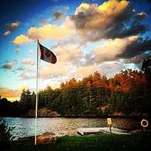
Cottage life
Approximately 230 cottages have been built on the lake. Partial road access. 25 town houses were recently built at The Landing marina. Fishing is reportedly good, though not as good as the uninhabited lakes upstream. The Anstruther Lake Cottager's Association hosts an annual regatta (Civic Holiday) and corn roast (Labour Day). There is a Marina is on this lake to provide gas, boat services and necessities.
References
- "Anstruther Lake". Geographical Names Data Base. Natural Resources Canada. Retrieved 2010-06-30.
- "Toporama - Topographic Map Sheet 31D16". Atlas of Canada. Natural Resources Canada. Archived from the original on 2010-08-31. Retrieved 2010-06-30.