Arabika Massif

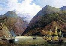
Arabika Massif is a glacially eroded karst outcropping of the Gagra Range, Abkhazia[note 1] in the West Caucasus, by the city of Gagra. The highest elevation is 2,661 metres (8,730 ft).[1]
The 13-km-long massif is composed of Lower Cretaceous and Upper Jurassic limestones that dip continuously southwest to the Black Sea and plunge below the modern sea level.[2] The area is densely wooded, with large areas of both coniferous forest and mixed woodland.
The Arabika contains a number of remarkable caves, gorges, wells, and precipices, including the Voronya Cave, the world's deepest cave. Alexander Kruber was the first to explore some of these features in 1909.
According to Rebecca Felix, the Arabica's "towering heights of limestone suggest the possibility of amazingly deep caves, boring the length of the massif and into the earth below its base".[3]
Notes
- ↑ Abkhazia's status is disputed. It considers itself to be an independent state, but this is recognised by only a few other countries. The Georgian government and most of the world's other states consider Abkhazia de jure a part of Georgia's territory. In Georgia's official subdivision it is an autonomous republic, whose government sits in exile in Tbilisi.
References
- ↑ Great Soviet Encyclopaedia
- ↑ Tabor, James M. (2010). Blind Descent: The quest to discover the deepest place on Earth. New York: Random House. p. 159. ISBN 978-1-4000-6767-1.
- ↑ Felix, R. (2014). Exploring Caves. ABDO Publishing Company. p. 48. ISBN 9781629680453. Retrieved 2015-04-13.
Coordinates: 43°25′N 40°20′E / 43.41°N 40.34°E