Arc (Provence)
| Arc | |
|---|---|
|
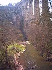
The Arc flowing underneath the Roquefavour Aqueduct | |
| Country | France |
| Basin | |
| Main source |
near Pourcieux 470 m (1,540 ft) |
| River mouth |
Étang de Berre 43°30′24″N 5°6′49″E / 43.50667°N 5.11361°ECoordinates: 43°30′24″N 5°6′49″E / 43.50667°N 5.11361°E |
| Basin size | 727 km2 (281 sq mi) |
| Physical characteristics | |
| Length | 83 km (52 mi) |
The Arc is an 83-kilometre (52 mi) long river in the south of France.[1] It arises at an elevation of 470 metres (1,540 ft), close to the village of Pourcieux. It then passes through Aix-en-Provence before flowing into the Étang de Berre, a lagoon connected with the Mediterranean Sea to the west of Marseille. Its drainage basin, with a surface area of 727 square kilometres (281 sq mi), is divided between two départments, Var and Bouches-du-Rhône. The Bayeux, the Cause and the Torse are its tributaries.
References
This article is issued from Wikipedia - version of the 9/22/2016. The text is available under the Creative Commons Attribution/Share Alike but additional terms may apply for the media files.