Arkansas Highway 20
| ||||
|---|---|---|---|---|
 | ||||
| Route information | ||||
| Maintained by AHTD | ||||
| Length: | 31.76 mi[1] (51.11 km) | |||
| Existed: | 1926 – present | |||
| Major junctions | ||||
| West end: |
| |||
| East end: |
| |||
| Location | ||||
| Counties: | Phillips | |||
| Highway system | ||||
| ||||

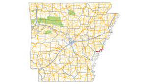
Arkansas Highway 20 (AR 20, Hwy. 20) is an east–west state highway in Phillips County, Arkansas. The route of 31.76 miles (51.11 km) runs from Lambrook northeast to US 49 in Helena-West Helena.[2] Segments of the route make up the western routing of the Great River Road.[3]
Route description
AR 20 begins near Lambrook facing south at County Route 622 when the route turns due east. After the highway passes the Lambrook post office, the route serves as the routhern terminus for Highway 318 and turns southeast toward Elaine. The city brings a junction with Highway 44, after which AR 20 becomes a minor state highway winding along the Mississippi River. The route passes through the unincorporated community of Modoc before forming its only spur route. This spur runs due south to the Mississippi River. The parent thighway AR 20 continues as a two-lane rural route, meeting AR 44 in south Helena-West Helena before terminating at US 49.
Great River Road
The Great River Road runs on AR 20 from US 49 to AR 44 in the extreme southern part of Helena-West Helena. The scenic byway follows AR 44 south to Elaine, when the Great River Road joins with AR 20 westbound. The route remains scenic until the junction with AR 318 east of Lambrook.[3]
History

Highway 20 was one of the original state highways, designated in 1926.[4] The route began at Highway 3 in east Monroe County and ran east through Marvell and Barton on its way to Helena, when the route turned south. Highway 20 continued south along its current routing from Helena, then along its present spur route to terminate at the Mississippi River.[4] Highway 3 was later replaced by US 49/AR 1 in the area, at which time AR 20 was extended south. Highway 20 was later extended west to the Lambrook area.
Major intersections
The entire route is in Phillips County.
| Location | mi[1] | km | Destinations | Notes | |
|---|---|---|---|---|---|
| Lambrook | 0.00 | 0.00 | western terminus | ||
| | 2.19 | 3.52 | |||
| Elaine | 8.26 | 13.29 | |||
| | 25.56 | 41.13 | |||
| Helena-West Helena | 31.56 | 50.79 | |||
| 31.76 | 51.11 | eastern terminus | |||
| 1.000 mi = 1.609 km; 1.000 km = 0.621 mi | |||||
Spur route
| |
|---|---|
| Location: | Phillips County |
| Length: | 1.92 mi[1] (3.09 km) |
Arkansas Highway 20 Spur is a spur route in east Phillips County. It is a former alignment of AR 20 that leads to a levee on the Mississippi River.[2]
- Major intersections
The entire route is in Phillips County.
| Location | mi[2] | km | Destinations | Notes | |
|---|---|---|---|---|---|
| | 0.00 | 0.00 | northern terminus | ||
| | 1.92 | 3.09 | Mississippi River levee | southern terminus | |
| 1.000 mi = 1.609 km; 1.000 km = 0.621 mi | |||||
References
- 1 2 3 Planning and Research Division (2010). "Arkansas Road Log Database". Arkansas State Highway and Transportation Department. Archived from the original (Database) on 23 June 2011. Retrieved June 9, 2011.
- 1 2 3 General Highway Map (PDF) (Map) (Phillips County ed.). Arkansas State Highway and Transportation Department. Retrieved June 20, 2011.
- 1 2 The Mississippi River plus The Great River Road (PDF) (Map). Experience Mississippi River. Archived (PDF) from the original on 10 July 2011. Retrieved June 20, 2011.
- 1 2 Map of State of Arkansas showing System of State Highways (Map) (1926 ed.). Arkansas State Highway Commission. Archived from the original on 7 July 2011. Retrieved June 20, 2011.