Arkansas Highway 219
| ||||
|---|---|---|---|---|
| Route information | ||||
| Maintained by AHTD | ||||
| Existed: | July 10, 1957[1] – present | |||
| Section 1 | ||||
| Length: | 10.88 mi[2] (17.51 km) | |||
| South end: |
| |||
| North end: |
| |||
| Section 2 | ||||
| Length: | 1.50 mi[2] (2.41 km) | |||
| South end: |
| |||
| North end: |
| |||
| Highway system | ||||
| ||||

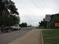
Arkansas Highway 219 is a designation for two state highways in Franklin County, Arkansas. The southern segment of 1.50 miles (2.41 km) runs from Citadel Bible College northeast to Ozark.[2] A northern segment of 10.88 miles (17.51 km) runs from U.S. Route 64 through Ozark northeast to Missouri state line.[3]
Route description
Ozark to CR 312
AR 219 begins in Ozark at US 64 near the Ozark Courthouse Square Historic District, which is listed on the National Register of Historic Places listings in Franklin County, Arkansas. The route runs north through Ozark, including a junction with Airport Rd, which provides access to the Ozark-Franklin County Airport. AR 219 continues north over Interstate 40 to intersect AR 352 in Mountain Grove. After Mountain Grove, AR 219 continues north to terminate at County Road 312 near a church in rural Franklin County. The road is entirely two-lane undivided.[2]
Citadel Bible College to Ozark
AR 219 begins at County Road 71 near Citadel Bible College and runs north to terminate at US 64. This portion does not cross or concur with any other state highways. The route is near the Arkansas River, and is a curved, narrow, two-lane road for its entire length.[2]
History
Highway 219 from Ozark north to an area around Mountain Top was added to the state highway system by the Arkansas State Highway Commission on July 10, 1957.[1] The route was paved around 1963, and again most recently in 1975.[2] The shorter route was added to the state highway system in 1966.[4] The route has not been repaved or reconstructed since its addition to the state highway system.[2]
Major intersections
Southern segment
The entire route is in Franklin County.
| Location | mi[2] | km | Destinations | Notes | |
|---|---|---|---|---|---|
| | 0.0 | 0.0 | Entrance to Citadel Bible College | ||
| Ozark | 1.50 | 2.41 | |||
| 1.000 mi = 1.609 km; 1.000 km = 0.621 mi | |||||
Northern segment
The entire route is in Franklin County.
| Location | mi[2] | km | Destinations | Notes | |
|---|---|---|---|---|---|
| Ozark | 0.0 | 0.0 | |||
| 1.79 | 2.88 | AR 96 eastern terminus | |||
| 2.05 | 3.30 | Exit 37 (I-40) | |||
| Mountain Grove | 3.71 | 5.97 | |||
| | 10.88 | 17.51 | |||
| 1.000 mi = 1.609 km; 1.000 km = 0.621 mi | |||||
References
- 1 2 "Minutes of the Meeting" (PDF). Arkansas State Highway Commission. July 10, 1957. p. 1784. Retrieved June 10, 2013.
- 1 2 3 4 5 6 7 8 9 "[Arkansas] State Highways 2009 (Database)." April 2010. AHTD: Planning and Research Division. Database. Retrieved May 23, 2011.
- ↑ General Highway Map - Franklin County, Arkansas (PDF) (Map) (January 3, 2011 ed.). Arkansas State Highway and Transportation Department. Retrieved May 23, 2011.
- ↑ "Minutes of the Meeting" (PDF). Arkansas State Highway Commission. June 23, 1965. p. 667. Retrieved June 10, 2013.