Arkansas Highway 238
| ||||
|---|---|---|---|---|
| Route information | ||||
| Maintained by AHTD | ||||
| Length: | 17.57 mi[1] (28.28 km) | |||
| Existed: | July 10, 1957[2] – present | |||
| Major junctions | ||||
| West end: |
| |||
| East end: |
| |||
| Location | ||||
| Counties: | Lee, Monroe | |||
| Highway system | ||||
| ||||

Highway 238 (AR 238, Ark. 238, and Hwy. 238) is an east–west state highway in the Lower Arkansas Delta. The route of 17.57 miles (28.28 km) begins at US Highway 49/US Highway 70 (US 49/US 70) in Brinkley and runs east to US 79 near Moro. The route is maintained by the Arkansas State Highway and Transportation Department (AHTD).
Route description
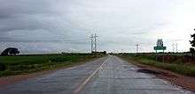

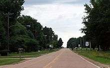
Highway 238 begins at US 49/US 70 in Brinkley in the Arkansas Delta. The route runs east and south to an intersection with Highway 238 Spur before turning due east as a section line road and running to Lee County.[3] Highway 238 continues east, crossing Big Creek and intersecting Highway 259 before entering Moro. In the town, Highway 238 intersects Highway 78 Spur near a city park. The route continues out of town heading south to US 79, where it terminates.[4]
History
The highway was added to the state highway system by the Arkansas State Highway Commission on July 10, 1957 as a road between State Road 39 (now US 49) and the Pleasant Valley community. Highway 238 was extended west to Grand Ave in Brinkley during a rerouting of east-west highways in the vicinity on September 5, 1962.[2] This action also created Highway 238 Spur.[5] The route was extended east from Pleasant Valley to US 79 on June 23, 1965.[6]
Highway 238 was rerouted from Cypress St to Sycamore St in Brinkley on May 29, 1975.[7]
Major intersections
| County | Location | mi[1] | km | Destinations | Notes |
|---|---|---|---|---|---|
| Monroe | Brinkley | 0.00 | 0.00 | Western terminus | |
| 0.86 | 1.38 | Northern terminus of AR 238S | |||
| Lee | | 13.66 | 21.98 | Southern terminus of AR 259 | |
| Moro | 16.08 | 25.88 | Eastern terminus of AR 78S | ||
| | 17.57 | 28.28 | Eastern terminus | ||
| 1.000 mi = 1.609 km; 1.000 km = 0.621 mi | |||||
Spur route
| |
|---|---|
| Location: | Brinkley |
| Length: | 0.65 mi[1] (1.05 km) |
| Existed: | September 5, 1962[5]–present |
Highway 238 Spur (AR 238, Ark. 238S, and Hwy. 238S) is a spur route of 0.65 miles (1.05 km) in Brinkley. The route begins at Highway 238 and runs south to US 49 at the southern edge of Brinkley, where it terminates.[3] The route was created on September 5, 1962. The route was designated during a reorganization of route numbers to increase continuity between Brinkley and Helena.[5]
Major intersections
The entire route is in Brinkley, Monroe County.
| mi[1] | km | Destinations | Notes | ||
|---|---|---|---|---|---|
| 0.00 | 0.00 | Northern terminus | |||
| 0.65 | 1.05 | Southern terminus | |||
| 1.000 mi = 1.609 km; 1.000 km = 0.621 mi | |||||
See also
-
 Arkansas portal
 -
 U.S. Roads portal
References
- 1 2 3 4 System Information and Research Division (2014). "Arkansas Road Log Database" (MDB). Arkansas State Highway and Transportation Department. Retrieved March 27, 2016.
- 1 2 "Minutes" (1953–69), p. 1789-1790.
- 1 2 Arkansas State Highway and Transportation Department (April 3, 2014). General Highway Map, Monroe County, Arkansas (PDF) (Map). 1:62500. Arkansas State Highway and Transportation Department. Retrieved November 20, 2016.
- ↑ Arkansas State Highway and Transportation Department (February 17, 2015). General Highway Map, Lee County, Arkansas (PDF) (Map). 1:62500. Arkansas State Highway and Transportation Department. Retrieved November 20, 2016.
- 1 2 3 "Minutes" (1953–69), p. 1112.
- ↑ "Minutes" (1953–69), p. 663.
- ↑ "Minutes" (1970–79), p. 825.
- "Minutes of the Meeting" (PDF). Arkansas State Highway Commission. 1953–69. Retrieved November 20, 2016.
- "Minutes of the Meeting" (PDF). Arkansas State Highway Commission. 1970–79. Retrieved November 20, 2016.
External links
-
 Media related to Arkansas Highway 238 at Wikimedia Commons