Arrondissement of Colmar
| Colmar | |
|---|---|
| Arrondissement of France | |
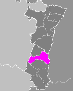 Location of Colmar in Alsace | |
| Country | France |
| Region | Alsace |
| Department | Haut-Rhin |
| Cantons | 6 |
| Communes | 62 |
| Prefecture | Colmar |
| Area¹ | |
| • Total | 666 km2 (257 sq mi) |
| Population (2006) | |
| • Total | 144,700 |
| • Density | 220/km2 (560/sq mi) |
| ¹ French Land Register data, which exclude lakes, ponds, and glaciers larger than 1 km² as well as the estuaries of rivers. | |
The arrondissement of Colmar is a former arrondissement of France in the Haut-Rhin department in the Alsace region. In 2015 it was merged into the new arrondissement of Colmar-Ribeauvillé.[1] It had six cantons and 62 communes. In 2006, it had a total population of 144,700.[2]
Composition
Cantons
The cantons of the arrondissement of Colmar were:
- Andolsheim
- Colmar-Nord
- Colmar-Sud
- Munster
- Neuf-Brisach
- Wintzenheim
Communes
The communes of the arrondissement of Colmar, and their INSEE codes, were:
| 1. Algolsheim (68001) | 2. Andolsheim (68007) | 3. Appenwihr (68008) |
| 4. Artzenheim (68009) | 5. Balgau (68016) | 6. Baltzenheim (68019) |
| 7. Biesheim (68036) | 8. Bischwihr (68038) | 9. Breitenbach-Haut-Rhin (68051) |
| 10. Colmar (68066) | 11. Dessenheim (68069) | 12. Durrenentzen (68076) |
| 13. Eguisheim (68078) | 14. Eschbach-au-Val (68083) | 15. Fortschwihr (68095) |
| 16. Geiswasser (68104) | 17. Griesbach-au-Val (68109) | 18. Grussenheim (68110) |
| 19. Gunsbach (68117) | 20. Heiteren (68130) | 21. Herrlisheim-près-Colmar (68134) |
| 22. Hettenschlag (68136) | 23. Hohrod (68142) | 24. Holtzwihr (68143) |
| 25. Horbourg-Wihr (68145) | 26. Houssen (68146) | 27. Husseren-les-Châteaux (68150) |
| 28. Jebsheim (68157) | 29. Kunheim (68172) | 30. Logelheim (68189) |
| 31. Luttenbach-près-Munster (68193) | 32. Metzeral (68204) | 33. Mittlach (68210) |
| 34. Muhlbach-sur-Munster (68223) | 35. Munster (68226) | 36. Muntzenheim (68227) |
| 37. Nambsheim (68230) | 38. Neuf-Brisach (68231) | 39. Obermorschwihr (68244) |
| 40. Obersaasheim (68246) | 41. Riedwihr (68272) | 42. Sainte-Croix-en-Plaine (68295) |
| 43. Sondernach (68311) | 44. Soultzbach-les-Bains (68316) | 45. Soultzeren (68317) |
| 46. Stosswihr (68329) | 47. Sundhoffen (68331) | 48. Turckheim (68338) |
| 49. Urschenheim (68345) | 50. Vœgtlinshoffen (68350) | 51. Vogelgrun (68351) |
| 52. Volgelsheim (68352) | 53. Walbach (68354) | 54. Wasserbourg (68358) |
| 55. Weckolsheim (68360) | 56. Wettolsheim (68365) | 57. Wickerschwihr (68366) |
| 58. Widensolen (68367) | 59. Wihr-au-Val (68368) | 60. Wintzenheim (68374) |
| 61. Wolfgantzen (68379) | 62. Zimmerbach (68385) |
References
Coordinates: 48°05′00″N 7°22′00″E / 48.0833°N 7.3667°E
This article is issued from Wikipedia - version of the 5/22/2015. The text is available under the Creative Commons Attribution/Share Alike but additional terms may apply for the media files.