Arrondissement of Senlis
| Senlis | |
|---|---|
| Arrondissement of France | |
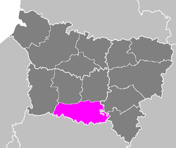 Location of Senlis in Picardy | |
| Country | France |
| Region | Hauts-de-France |
| Department | Oise |
| Communes | 133 |
| Subprefecture | Senlis |
| Area¹ | |
| • Total | 1,344 km2 (519 sq mi) |
| Population (2013) | |
| • Total | 278,751 |
| • Density | 210/km2 (540/sq mi) |
| ¹ French Land Register data, which exclude lakes, ponds, and glaciers larger than 1 km² as well as the estuaries of rivers. | |
The arrondissement of Senlis is an arrondissement of France in the Oise department in the Hauts-de-France region. It has 133 communes.
Composition
Cantons
The cantons of the arrondissement of Senlis are:
- Chantilly
- Creil
- Crépy-en-Valois
- Méru (partly)
- Montataire (partly)
- Nanteuil-le-Haudouin
- Nogent-sur-Oise (partly)
- Pont-Sainte-Maxence (partly)
- Senlis
Communes
The communes of the arrondissement of Senlis, and their INSEE codes, are:
| 1. Acy-en-Multien (60005) | 2. Antilly (60020) | 3. Apremont (60022) |
| 4. Auger-Saint-Vincent (60027) | 5. Aumont-en-Halatte (60028) | 6. Autheuil-en-Valois (60031) |
| 7. Avilly-Saint-Léonard (60033) | 8. Balagny-sur-Thérain (60044) | 9. Barbery (60045) |
| 10. Bargny (60046) | 11. Baron (60047) | 12. Beaurepaire (60056) |
| 13. Belle-Église (60060) | 14. Betz (60069) | 15. Blaincourt-lès-Précy (60074) |
| 16. Boissy-Fresnoy (60079) | 17. Bonneuil-en-Valois (60083) | 18. Boran-sur-Oise (60086) |
| 19. Borest (60087) | 20. Bouillancy (60091) | 21. Boullarre (60092) |
| 22. Boursonne (60094) | 23. Brasseuse (60100) | 24. Brégy (60101) |
| 25. Béthancourt-en-Valois (60066) | 26. Béthisy-Saint-Martin (60067) | 27. Béthisy-Saint-Pierre (60068) |
| 28. Chamant (60138) | 29. Chambly (60139) | 30. Chantilly (60141) |
| 31. Chèvreville (60148) | 32. Cires-lès-Mello (60155) | 33. Courteuil (60170) |
| 34. Coye-la-Forêt (60172) | 35. Cramoisy (60173) | 36. Creil (60175) |
| 37. Crouy-en-Thelle (60185) | 38. Crépy-en-Valois (60176) | 39. Cuvergnon (60190) |
| 40. Dieudonné (60197) | 41. Duvy (60203) | 42. Ercuis (60212) |
| 43. Ermenonville (60213) | 44. Feigneux (60231) | 45. Fleurines (60238) |
| 46. Fontaine-Chaalis (60241) | 47. Foulangues (60249) | 48. Fresnoy-en-Thelle (60259) |
| 49. Fresnoy-la-Rivière (60260) | 50. Fresnoy-le-Luat (60261) | 51. Gilocourt (60272) |
| 52. Glaignes (60274) | 53. Gondreville (60279) | 54. Gouvieux (60282) |
| 55. Ivors (60320) | 56. La Chapelle-en-Serval (60142) | 57. La Villeneuve-sous-Thury (60679) |
| 58. Lagny-le-Sec (60341) | 59. Lamorlaye (60346) | 60. Le Mesnil-en-Thelle (60398) |
| 61. Le Plessis-Belleville (60500) | 62. Lévignen (60358) | 63. Mareuil-sur-Ourcq (60380) |
| 64. Marolles (60385) | 65. Maysel (60391) | 66. Mello (60393) |
| 67. Mont-l'Évêque (60421) | 68. Montagny-Sainte-Félicité (60413) | 69. Montataire (60414) |
| 70. Montlognon (60422) | 71. Montépilloy (60415) | 72. Morangles (60429) |
| 73. Morienval (60430) | 74. Mortefontaine (60432) | 75. Nanteuil-le-Haudouin (60446) |
| 76. Neufchelles (60448) | 77. Neuilly-en-Thelle (60450) | 78. Nogent-sur-Oise (60463) |
| 79. Néry (60447) | 80. Ognes (60473) | 81. Ognon (60475) |
| 82. Ormoy-Villers (60479) | 83. Ormoy-le-Davien (60478) | 84. Orrouy (60481) |
| 85. Orry-la-Ville (60482) | 86. Plailly (60494) | 87. Pont-Sainte-Maxence (60509) |
| 88. Pontarmé (60505) | 89. Pontpoint (60508) | 90. Précy-sur-Oise (60513) |
| 91. Puiseux-le-Hauberger (60517) | 92. Péroy-les-Gombries (60489) | 93. Raray (60525) |
| 94. Rhuis (60536) | 95. Roberval (60541) | 96. Rocquemont (60543) |
| 97. Rosières (60546) | 98. Rosoy-en-Multien (60548) | 99. Rouville (60552) |
| 100. Rouvres-en-Multien (60554) | 101. Rully (60560) | 102. Russy-Bémont (60561) |
| 103. Réez-Fosse-Martin (60527) | 104. Saint-Leu-d'Esserent (60584) | 105. Saint-Maximin (60589) |
| 106. Saint-Vaast-de-Longmont (60600) | 107. Saint-Vaast-lès-Mello (60601) | 108. Saintines (60578) |
| 109. Senlis (60612) | 110. Silly-le-Long (60619) | 111. Séry-Magneval (60618) |
| 112. Thiers-sur-Thève (60631) | 113. Thiverny (60635) | 114. Thury-en-Valois (60637) |
| 115. Trumilly (60650) | 116. Ully-Saint-Georges (60651) | 117. Varinfroy (60656) |
| 118. Vauciennes (60658) | 119. Vaumoise (60661) | 120. Ver-sur-Launette (60666) |
| 121. Verberie (60667) | 122. Verneuil-en-Halatte (60670) | 123. Versigny (60671) |
| 124. Vez (60672) | 125. Villeneuve-sur-Verberie (60680) | 126. Villers-Saint-Frambourg (60682) |
| 127. Villers-Saint-Genest (60683) | 128. Villers-Saint-Paul (60684) | 129. Villers-sous-Saint-Leu (60686) |
| 130. Vineuil-Saint-Firmin (60695) | 131. Ève (60226) | 132. Éméville (60207) |
| 133. Étavigny (60224) |
External links
Coordinates: 49°12′00″N 2°35′00″E / 49.2000°N 2.5833°E
This article is issued from Wikipedia - version of the 11/18/2016. The text is available under the Creative Commons Attribution/Share Alike but additional terms may apply for the media files.