Aslackby and Laughton
| Aslackby and Laughton | |
 St James' Church, Aslackby |
|
 Aslackby and Laughton |
|
| Population | 251 (2011) |
|---|---|
| OS grid reference | TF083305 |
| – London | 95 mi (153 km) S |
| Civil parish | Aslackby and Laughton |
| District | South Kesteven |
| Shire county | Lincolnshire |
| Region | East Midlands |
| Country | England |
| Sovereign state | United Kingdom |
| Post town | Sleaford |
| Postcode district | NG34 |
| Police | Lincolnshire |
| Fire | Lincolnshire |
| Ambulance | East Midlands |
| EU Parliament | East Midlands |
| UK Parliament | Grantham and Stamford |
|
|
Coordinates: 52°51′55″N 0°23′41″W / 52.8654°N 0.39482°W
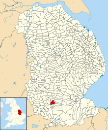
Aslackby and Laughton is a civil parish[1] in the South Kesteven district of Lincolnshire, England. According to the 2001 census the parish had a population of 243,[1] in 102 households.[2] increasing slightly to 251 in 118 households at the 2011 census.[3] It consists of the village of Aslackby, the hamlet of Laughton, and scattered farms.[4]
Aslackby
52°51′40″N 0°23′18″W / 52.86111°N 0.38833°W
Aslackby (pronounced Aze-ul-be) is a small village extending westwards from the A15 road between Rippingale and Folkingham, about halfway between Sleaford and Bourne.
Aslackby Grade I listed Anglican church is dedicated to St James.[5] The chancel is Early English, largely rebuilt 1856, with the tower and nave, Perpendicular.[6][7] The ecclesiastical parish is Aslackby, part of The Billingborough Group of the Lafford Deanery[8]
There is a dining club, The Templars, for long-term residents, and a local history society.[1]
History
The Aveland, a moat said to be the meeting place for the Wapentake of Aveland is in the parish.[9] There is documentary evidence for a settlement called Avethorpe, from the Domesday survey onwards, but no actual location is known.[10]
In 1164 the Knights Templar established a preceptory at Aslackby, from where their local estates were managed, and which resulted in high-status village buildings. However, with the transfer of the preceptory to the Hospitalers it was no longer needed, and little now remains.
In the 1940s, Folkingham Airfield was developed close to Temple Wood. It was from there that parts of Operation Market were flown.
Laughton
52°52′20″N 0°23′57″W / 52.87222°N 0.39917°W
The hamlet of Laughton lies less than 1 mile (1.6 km) to the north of Aslackby. West Laughton at its south-west is the site of a deserted medieval village (DMV).[11][12][13]
Employment
Most work in the area remains agricultural, with further employment at an equestrian centre, a public house, and a metal tube manufacturing company. Commuting to Grantham, Sleaford or Bourne for work is common.
Lincolnshire preceptories
Until their disbandment in 1312, the Knights Templar were major landowners on the higher lands of Lincolnshire, where they had a number of preceptories on property which provided income, while Temple Bruer was an estate on the Lincoln Heath, believed to have been used also for military training.[14] The preceptories from which the Lincolnshire properties were managed were:[15]
- Aslackby Preceptory, Kesteven (TF0830)
- Bottesford, Lindsey (SE8907)
- Eagle, Kesteven (SK875672)
- Great Limber, Lindsey (TA1308)
- Horkstow, Lindsey (SE9818)
- Witham Preceptory, Kesteven (SK928205)
- Temple Bruer, Kesteven (TF0054)
- Willoughton Preceptory, Lindsey (SK923931)
- Byard's Leap (SK990494) was part of the Temple Bruer estate.
Gallery
-
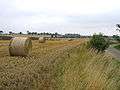
Typical agricultural scene in Laughton
-
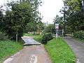
The ford in Aslackby
-

Laughton Manor Farm from the air
-

Aslackby village from the air
References
- 1 2 3 "Civil Parish details".
- ↑ "2001 census". Neighbourhood Statistics. Office for National Statistics. Retrieved 20 April 2013.
- ↑ "Civil parish population 2011". Neighbourhood Statistics. Office for National Statistics. Retrieved 21 April 2016.
- ↑ "Parish Boundary map from SKDC".
- ↑ Historic England. "Church of St James (1062757)". National Heritage List for England. Retrieved 9 July 2011.
- ↑ "Church web site".
- ↑ Historic England. "Church (348722)". PastScape. Retrieved 11 April 2010.
- ↑ "Aslackby P C C"., Diocese of Lincoln
- ↑ Historic England. "The Aveland moat (348358)". PastScape. Retrieved 4 July 2010.
- ↑ Historic England. "Natnional Monument record for Avethorpe (348363)". PastScape. Retrieved 4 July 2010.
- ↑ Bourne & Heckington: Billingborough & Morton (Map) (3 ed.). 1:25000. OS Explorer Map. OSGB. 2006. p. 248. ISBN 978-0-319-23811-0. Retrieved 9 April 2010.West Laughton TF074311
- ↑ Historic England. "West Laughton (348714)". PastScape. Retrieved 11 April 2010.
- ↑ Historic England. "Additional settlement at Laughton (1041290)". PastScape. Retrieved 11 April 2010.
- ↑ Ward, Penny. Dennis Mills (2nd ed.), ed. The Knights Templar in Kesteven (2 ed.). Heckington: Heritage Lincolnshire Publications. ISBN 978-0-948639-47-0.
- ↑ Page, William, ed. (1906). A History of the County of Lincoln. Victoria County History. 2. pp. 210–213 'Houses of Knights Templars: Willoughton, Eagle, Aslackby, South Witham and Temple Bruer'. Retrieved 12 February 2011.
External links
 Media related to Aslackby and Laughton at Wikimedia Commons
- "Aslackby and Laughton Parish Council", Lincolnshire Parish Councils: South Kesteven. Retrieved 9 July 2011
- "Aslackby", homepages.which.net. Retrieved 9 July 2011
- Aslackby: historical and genealogical information at GENUKI.
- Aslackby in the Domesday Book
- Laughton in the Domesday Book
England Portal | |
| Unitary authorities | |
| Boroughs or districts | |
| Major settlements |
|
| Topics | |