Atambua
| Atambua | |
|---|---|
 Atambua | |
| Coordinates: 9°6′22″S 124°53′33″E / 9.10611°S 124.89250°ECoordinates: 9°6′22″S 124°53′33″E / 9.10611°S 124.89250°E | |
| Country | Indonesia |
| Province | East Nusa Tenggara |
| Regency | Belu |
| Area | |
| • Total | 32.8 km2 (12.7 sq mi) |
| Elevation | 350 m (1,150 ft) |
| Population (2011) | |
| • Total | 72.373 |
| • Metro density | 1.288/km2 (3.34/sq mi) |
| Time zone | WITA / UTC (UTC+8) |
| Climate | Aw |
Atambua is seat capital of Belu Regency, East Nusa Tenggara, Indonesia. The town stretches as far as 8.5 km from North to South and 5 km from East to West, and is located in the north of the western half of Timor Island. The town is located at an altitude of about 350 m above sea level with temperatures ranging between 25-37 degrees Celsius making this area feel quite warm.
In September 1999, 250,000 refugees arrived here from East Timor, after their vote for independence and the following violence. As late as 2002 there was an estimated 60,000 refugees left in camps.[1]
The town is home to the Roman Catholic Diocese of Atambua. The Diocese's population is over 95% Catholic, among the highest percentages of Catholics in all of Indonesia.
Schools
There are many schools in Atambua, which are:
- Atambua Catholic Elementary School no. 1 (SDK Atambua 1)
- Atambua Catholic Elementary School no. 2 (SDK Atambua 2)
- Atambua Protestantism Elementary School no. 3 (SD Gmit Atambua 3)
- Atambua 1st Junior High School (SMP Negeri 1 Atambua)
- Atambua 2nd Junior High School (SMP Negeri 2 Atambua)
- Atambua 3rd Junior High School (SMP Negeri 3 Atambua)
- St. Yohanes Don Bosco Catholic Junior High School (SMPK St. Yohanes Don Bosko Atambua)
- Atambua 1st Senior High School (SMA Negeri 1 Atambua)
- Atambua 2nd Senior High School (SMA Negeri 2 Atambua)
- Suria Catholic Senior High School (SMAK Suria Atambua)
- Atambua 1st Vocational High School (SMK Negeri 1 Atambua)
Media
Television
As like Belu Regency, the television in this city is limited, which are:
- TVRI (VHF 10 & VHF 20)
- Belu TV (VHF 37
Radio AM/FM
In this city, there are many radios, which are:
| No. | Name of Radio | Frequency |
|---|---|---|
| 1 | RRI Programa 1 Atambua | FM 91.5 MHz |
| 2 | RRI Programa 2 Atambua | FM 99.8 MHz |
| 3 | RRI Programa 3 | FM 99.0 MHz |
| 4 | RRI Programa 4 Atambua (SCBT*) | FM 93.1 MHz |
| 5 | RSPD Belu | FM 107.3 MHz |
| 6 | RSPD2 Belu | FM 93.9 MHz, AM 1034 MHz |
| 7 | Favorit Radio | FM 98.2 MHz |
| 8 | Radio Dian Mandiri | FM 100.6 MHz |
| 9 | Misi Kalvari (Miskal) FM | FM 106.5 MHz |
*) SCBT means Saluran Citra Budaya Timor (Timor Culture Channel)
Transportation Systems
The town's transport system relies mainly on minibuses, usually called bemo or mikrolet, and motorcycles provide an alternative. The motorcycles are usually called ojek. There are only four routes in the town served by the Mikrolets that connect Atambua's main points. The ojeks do not have a fixed route.
Land Transportation
Inter-city buses connect Atambua with other towns in West Timor. The city and towns that can be connected are Kupang, Soe and Kefamenanu; the distance between Atambua and Kefamenanu is 87 km, between Atambua and Soe is 179 km, and between Atambua and Kupang is 289 km. Atambua is a major gateway to East Timor by land. To go to East Timor (Timor-Leste), the vehicles usually used by road to Indonesia-East Timor (Timor-Leste) Immigration checks in Motaain (Indonesia) near Batugade are mostly with Bus and Car, such as SUVs and MPVs and Motorcycles. The distance between Atambua and Motaain (Indonesia-Timor Leste borders) is 36 km.
Air Transportation
There is an airport in Atambua, A. A. Bere Talo Airport, about 5 kilometers from the town centre. The airport's runway is 1600m long and can therefore be used by a quite big aircraft. Daily flights to the airport is used by the Susi Air plane, Wings Air plane and Trans Nusa plane. All these flights are mainly on the Atambua - Kupang route.
Water Transportation
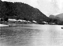
Atambua also has two sea ports, Atapupu for cargo and oil, and Teluk Gurita for passengers (ferry port). Ferry routes are Atambua-Kalabahi (Alor), once a week.