Ataq Airport
| Ataq Airport | |||||||||||
|---|---|---|---|---|---|---|---|---|---|---|---|
| IATA: AXK – ICAO: OYAT | |||||||||||
| Summary | |||||||||||
| Airport type | Public/Military | ||||||||||
| Location | Ataq, Yemen | ||||||||||
| Elevation AMSL | 3,735 ft / 1,138 m | ||||||||||
| Coordinates | 14°33′04″N 046°49′34″E / 14.55111°N 46.82611°ECoordinates: 14°33′04″N 046°49′34″E / 14.55111°N 46.82611°E | ||||||||||
| Map | |||||||||||
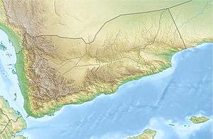
 OYAT Location of airport in Yemen | |||||||||||
| Runways | |||||||||||
| |||||||||||
Ataq Airport (IATA: AXK[3], ICAO: OYAT) is an airport serving Ataq,[1] the capital city of the Shabwah Governorate in Yemen.
Facilities
The airport resides at an elevation of 3,735 feet (1,138 m) above mean sea level. It has one runway designated 13/31 with an asphalt surface measuring 2,890 by 50 metres (9,482 ft × 164 ft).[1]
Airlines and destinations
All flights are currently suspended.[4]
| Airlines | Destinations |
|---|---|
| Felix Airways | Sana'a |
References
- 1 2 3 Airport information for OYAT from DAFIF (effective October 2006)
- ↑ Airport information for AXK at Great Circle Mapper. Source: DAFIF (effective October 2006).
- ↑ "Airline and Airport Code Search (AXK: Ataq)". International Air Transport Association (IATA). Retrieved 7 October 2012.
- ↑ Ghattas, Abir. "Yemen's No Fly Zone: Thousands of Yemenis are Stranded Abroad". Retrieved 8 April 2015.
External links
This article is issued from Wikipedia - version of the 5/19/2015. The text is available under the Creative Commons Attribution/Share Alike but additional terms may apply for the media files.