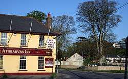
Athgarvan
| Athgarvan Irish: Áth Garbháin | |
|---|---|
| Village | |
|
Athgarvan | |
 Athgarvan Location in Ireland | |
| Coordinates: 53°09′11″N 6°46′41″W / 53.152999°N 6.7781885°W | |
| Country | Ireland |
| County | County Kildare |
| Elevation | 115 m (377 ft) |
| Population (2011)[1] | |
| • Total | 1,016 |
| Irish Grid Reference | N817120 |
Athgarvan (Irish: Áth Garbháin, meaning "Garvan's ford") is a village 4 km (2.5 mi) southwest of Newbridge in County Kildare, Ireland. It is on the R416 regional road and lies just west of the River Liffey which forms the eastern boundary of the village, while The Curragh forms its western boundary.
The M7 motorway lies just beyond its northern boundary and separates it from Newbridge, which has now expanded as far south as the M7, with the result that the edges of the two settlements are now just one kilometre apart. The population of the Village according to Census 2011 is 1016.
Future Development
While the latest development plan sees the village expanding towards the Curragh in the immediate future (up to 2011), the likelihood is that Athgarvan will become the first neighbouring settlement to be absorbed by the rapid expansion of the Newbridge urban area. The village itself has grown rapidly in recent years. There was an increase of over 400% in twelve years, from 322 in 1994 to over 1,300 in 2006. Ref:
Sport
- Athgarvan GAA
- Newbridge Rugby Football Club