Aue (Oste)
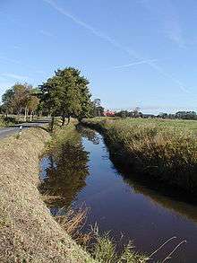 | |
| The Aue in Bülkau | |
| Location | Cuxhaven district, |
|---|---|
| Reference no. | DE: 5988 |
| Length | 14 km |
| Source | Pumping station on the Balksee in the parish of Wingst 53°42′13″N 9°00′36″E / 53.70362°N 9.01004°ECoordinates: 53°42′13″N 9°00′36″E / 53.70362°N 9.01004°E |
| Source height | 3 m above sea level (NN) |
| Mouth | Near Neuhaus (Oste) into the Oste 53°48′30″N 9°02′29″E / 53.80825°N 9.04140°E |
| Mouth height | 1 m above sea level (NN) |
| Descent | 2 m |
| Basin | Elbe |
| Progression | Oste → Elbe → North Sea |
| Catchment | 123 km² |
The Aue is a left, southwestern, tributary of the Oste in northern Lower Saxony, Germany. It is about 14 kilometres (8.7 mi) long.
Geography
Before the construction of the Neuhaus-Bülkau Canal the Aue was the natural outlet of the Balksee lake in the southwest part of the parish of Wingst on the southern edge of the collective municipality of Am Dobrock. The Balksee is, in turn, fed by several streams. The Aue today no longer has any direct link with the Balksee and rises on its northern edge. The Aue, as a former sea creek, has no natural gradient. The water level is artificially held below sea level by dyke sluices and a pumping station.
Tributaries
- Rönne
- Neuhaus-Bülkau Canal (most of the water from the Balksee and the old drainage basin of the Aue flows through this canal)
- Sprengeauswettern
- Splethauswettern
External links
| Wikimedia Commons has media related to Aue (Oste). |
This article is issued from Wikipedia - version of the 5/17/2016. The text is available under the Creative Commons Attribution/Share Alike but additional terms may apply for the media files.