Aytat
| Aitat | |
|---|---|
| Town | |
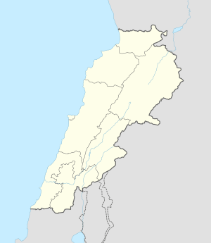 Aitat Aitat shown within Lebanon | |
| Coordinates: 33°47′30″N 35°33′26″E / 33.791607°N 35.557253°ECoordinates: 33°47′30″N 35°33′26″E / 33.791607°N 35.557253°E | |
| Country | Lebanon |
| Governorate | Mount Lebanon |
| District | Aley |
| City | Aley |
| ISO 3166 code | LB |
Aitat, or Aytat, is a town located 5 kilometres (3.1 mi) west of the town of Aley within the district of the same name in the Lebanese governorate of Mount Lebanon. It was a strategic place during the Lebanese Civil War (1975–1990), due to its view to Beirut.
Aitat has witnessed many tragic events, especially during the brutal Syrian Invasion. The latest was the firing of two rockets from the town hitting the Southern Suburbs of Beirut, the attack was linked to the Syrian terrorist groups fighting in Syria as a response to Hezbollah.
With its neighboring Christian town of Souk El-Gharb, this town remains one of the most memorial places in Lebanon for the Druze and the Chrisitans as a reminder the fierce and deadly battles that occurred during the Lebanese Civil War. Today Aitat and Souk El-Gharb are considered to be the symbol of unity and forgiveness.
The Abi Saab's, AL - Timany's and the Talhouq's are three of the most well known families of Aitat and the Aley district.
References
External links
- Aaytat, Localiban
Capital: Aley | ||
| Towns and villages | 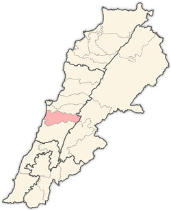 | |