Azad Kuh
| Azad Kuh | |
|---|---|
 Azad Kuh | |
| Highest point | |
| Elevation | 4,355 m (14,288 ft) [1] |
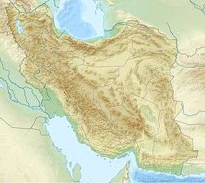
| Coordinates | 36°10′N 51°30′E / 36.167°N 51.500°ECoordinates: 36°10′N 51°30′E / 36.167°N 51.500°E |
| Geography | |
 Azad Kuh | |
| Parent range | Alburz |
| Climbing | |
| Easiest route | Kalaak-e-Baalaa |
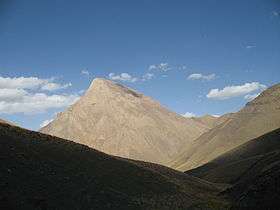
Azad Kuh (Persian: آزاد کوه) is one of the highest peaks in the central Alburz Range in Mazandaran province north of Iran. In Persian Kuh means mountain and Azad means free, so Azad Kuh can be translated to The Free Mountain. This name is probably chosen by local people because of Azad Kuh's cone like shape and the fact that it is not connected to its surrounding peaks.
Climbing Azad Kuh
Azad kuh is not a technical climb and you won't need any rock climbing gear (Carabiner, Rope ...) in summer. There are two routes for climbing this peak, the easier and shorter one is from Kalaak-e-Baalaa village and the longer one is from Vaarange Rud village. The former takes 1–2 days and the latter 2–3 days. There is no shelter in neither route and you need to carry your own tent if you are planning to camp. Azad Kuh is not such an easy climb in the winter as there is the potential danger of avalanche in either route.
References
- ↑ Scale 1:250,000, Amol, Iran, Sheet NJ 39-15, http://www.lib.utexas.edu/maps/jog/iran/txu-oclc-58750648-nj39-15.jpg