B1159 road
| |
|---|---|
|
Stow windmill, Paston, Norfolk with the B1159 in the foreground. | |
| Route information | |
| Length: | 32 mi (51 km) |
| Major junctions | |
| Northwest end: |
Cromer 52°55′46″N 1°18′12″E / 52.9295°N 1.3033°E |
| A149, B1145, B1150, B1151, B1152. | |
| Southeast end: |
Caister-on-Sea 52°39′01″N 1°42′49″E / 52.6503°N 1.7137°E |
| Road network | |


The B1159 is a road in Norfolk, England, running for about 32 miles (51 km) between Cromer and Caister-on-Sea, parallel to and at a short distance from the northeastern coast of Norfolk.
Made famous by Norfolk's modern English folk band, Addison's Uncle. Their debut single, titled B1159, gained extensive regional press coverage and they filmed a music video along the B1159 which can be viewed here: B1159 Music Video
From north to south the road passes through:
|
|
Sections of interest (north to south)
From about halfway between Cromer and Overstrand to Mundesley, the road parallels the disused course of the Norfolk and Suffolk Joint Railway, which can be glimpsed from time to time.
Between Paston and Bacton, "the road runs through acres of gasholders, pipes, control wheels and other gadgetry, all protected by formidable fences. This is the Bacton Natural Gas Terminal, which receives gas through pipelines from the offshore wells.".[1] The site is also one terminal of the Interconnector pipeline link with continental Europe.
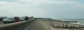
A quarter-mile stretch at Walcott is a section of this "coast road" that runs within close proximity to the sea, although somewhat more distant sea views are available at numerous other points, such as at Sidestrand, Trimingham and Mundesley [2][3]
See also
Notes and references
- Primary references
- 1:50,000 First Series Sheet 133 North East Norfolk, Ordnance Survey, 1974 - Cromer - Ingham Corner.
- 1:50,000 Landranger Sheet 134 Norwich & The Broads (Great Yarmouth), Edition C1, Ordnance Survey, 2000 - Whimpwell Green - Caister-on-Sea.
- Touring Guide to Britain, AA Publishing, 1986, ISBN 0-86145-605-X, in which the B1159 forms half of Tour 64.
- Inline references
- ↑ Illustrated Guide to Britain's Coast, Drive Publications Limited (for the AA), 1987, ISBN 0-903356-33-3.
- ↑ 1:50,000 First Series Sheet 133 North East Norfolk, Ordnance Survey, 1974
- ↑ 1:50,000 Landranger Sheet 134 Norwich & The Broads (Great Yarmouth), Edition C1, Ordnance Survey, 2000
External links
Coordinates: 52°49′18″N 1°31′56″E / 52.8218°N 1.5323°E