Bad Saarow
| Bad Saarow | |
|---|---|
|
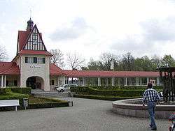
Railway station | |
 Bad Saarow | |
Location of Bad Saarow within Oder-Spree district 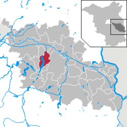 | |
| Coordinates: 52°16′59″N 14°04′00″E / 52.28306°N 14.06667°ECoordinates: 52°16′59″N 14°04′00″E / 52.28306°N 14.06667°E | |
| Country | Germany |
| State | Brandenburg |
| District | Oder-Spree |
| Municipal assoc. | Scharmützelsee |
| Government | |
| • Mayor | Susanne Rolle (CDU) |
| Area | |
| • Total | 51.98 km2 (20.07 sq mi) |
| Population (2015-12-31)[1] | |
| • Total | 5,251 |
| • Density | 100/km2 (260/sq mi) |
| Time zone | CET/CEST (UTC+1/+2) |
| Postal codes | 15526 |
| Dialling codes | 033631 |
| Vehicle registration | LOS |
| Website | www.bad-saarow.de |
Bad Saarow is a municipality in the Oder-Spree district, in Brandenburg, Germany.
The place is known for its hot springs and for its mineral rich mud. Their healing properties have attracted visitors for many years, and in 1923 led to the town's name acquiring the prefix "Bad".
Nearby are the Dubrower Berge a range of wooded hills popular with hikers and cyclists.
Demography
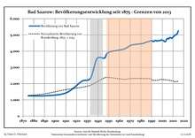
Development of Population since 1875 within the Current Boundaries (Blue Line: Population; Dotted Line: Comparison to Population Development of Brandenburg state; Grey Background: Time of Nazi rule; Red Background: Time of Communist rule)
|
|
|
|
Sons and daughters of the church
- Jörg Schönbohm (born 1937 in Neu Golm), former Lieutenant general of the Bundeswehr, 1999-2009 Minister of the Interior of the State of Brandenburg
- Cornelia Ernst (born 1956), politician (The Left)
- Marienetta Jirkowsky (1962-1980), Death at the Berlin wall
- Axel Schulz (born 1968), boxer
- Vivien Kussatz (born 1972), sailor
- Franziska Mietzner (born 1988), handball player
References
- ↑ "Bevölkerung im Land Brandenburg nach amtsfreien Gemeinden, Ämtern und Gemeinden 31. Dezember 2015 (Fortgeschriebene amtliche Einwohnerzahlen auf Grundlage des Zensus 2011)". Amt für Statistik Berlin-Brandenburg (in German). 2016.
- ↑ Detailed data sources are to be found in the Wikimedia Commons.Population Projection Brandenburg at Wikimedia Commons
| Wikimedia Commons has media related to Bad Saarow. |
This article is issued from Wikipedia - version of the 11/13/2016. The text is available under the Creative Commons Attribution/Share Alike but additional terms may apply for the media files.