Bagh District
| Bagh | |
|---|---|
| Town | |
|
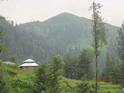
Ganga choti, Bagh AJK | |
 Bagh | |
| Coordinates: 33°58′25″N 73°47′30″E / 33.9735°N 73.7918°ECoordinates: 33°58′25″N 73°47′30″E / 33.9735°N 73.7918°E | |
| Country |
|
| State | Azad Kashmir |
| Headquarters | Bagh |
| Elevation | 1,038 m (3,406 ft) |
| Population | |
| • Total | 351,000 (1,998) |
| Languages | |
| • Official | Urdu |
| Time zone | PST |
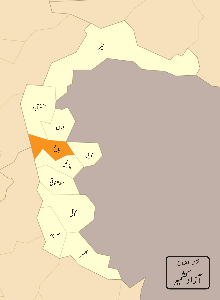
Bagh District (Urdu: ضلع باغ ) is one of the Ten districts of Azad Jammu and Kashmir, Pakistan. The district, which had been part of Poonch District, was created in 1988.[1] The district is bounded by Muzaffarabad District to the north, Poonch district to the south, and Poonch district of the Indian-administered Jammu and Kashmir to the east; it is bounded by the Punjab, Rawalpindi District and Abbottabad District of Pakistan's North-West Frontier Province to the west. The total area of the district is 1,368 square kilometers.[2] Bagh District is linked to Muzaffarabad by two roads, one via Sudhan Gali (80 km) and the other through Kohala (97 km). It is situated 46 km from Rawalakot. The district's headquarters is located at Bagh. It is said that a bagh (garden) was set up by the landowner where the premises of the Forest Department are now located. As a result, the area that is now the district headquarters was named “Bagh”.[3][4]
History
There is an archaeological site located in Bagh called Bagh Fort.[5]
Prior to 1947, Bagh was a tehsil in the Poonch district of Jammu and Kashmir.[6] During the Indo-Pakistani War of 1947, part of the Poonch district came under Indian control. The remaining part became part of Azad Kashmir.
The Bagh District was created in 1988, when it was separated from the Azad Kashmir's Poonch District.
Administrative divisions
The district of Bagh is sub-divided into 2 tehsils:
Geography and climate
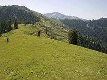
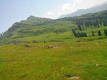
Topographically, the entire Bagh district is a mountainous area, generally sloping from northeast to south-west. The area falls in the lesser Himalayas zone. The main range in the district is Pir- Panjal. The Haji-Pir Pass is situated at the height of 3421 meters above sea level. The general elevation is between 1500 and 2500 meters above sea level. The mountains are generally covered with coniferous forests. Mahl Nala, in the Bagh sub-division, and Betar Nala, in the Haveli sub-division, are the two main streams. However, numerous other rivulets flow in the district.[7]
The climate of the district varies with altitude. The temperature generally remains between 2 °C to 40 °C. The main eastern part of the district is very cold in winter and moderate in summer. However, the lower valleys, the localities bordering Bagh at Kohala and its adjoining areas (Mongbajri and Ajra-Bagh) remain cold in winter and hot in summer. May, June and July are the hottest months. Maximum and minimum temperatures during the month of June are about 40 °C and 22 °C respectively. December, January and February are the coldest months. The maximum temperature in January is about 16 °C and minimum temperature is 3 °C respectively. Annual rainfall is about 1500 millimeters.[7]
Demography
The total population of the district according to the 1998 census was 395,000, which is estimated to have increased to 434,000 in 2013, with an annual growth rate of 2%.[8]
Notables People
- Shaheen Kausar Dar,ex Deupty Speaker of Ajk Assembly
- Sardar Abdul qayyum khan Abbasi,former prime minister of azad kashmir
Economy and resources
There are minerals in Bagh such as deposits of slate, where there are proven deposits of 1 million tons which are suitable for building materials, specifically roofing and flooring.[9]
Education
According to the Alif Ailaan Pakistan District Education Rankings 2015, Bagh is ranked 16 out of 148 districts in terms of education. For facilities and infrastructure, the district is ranked 108 out of 148.[10]
2005 earthquake in relation to Bagh district
The city of Bagh, like other areas of the district, was heavily damaged in the 2005 Kashmir earthquake. Sixty percent of the buildings collapsed. Thousands of people died and many more found themselves homeless. In the aftermath of the earthquake, NATO came to the district to help with reconstruction and clearing.[11] There was a report that an entire village was wiped out in the district.[12] The U.S., through Pakistan, distributed vouchers so people could buy water and food.[13]
References
- ↑ Government of Azad Kashmir
- ↑ Bagh District Statistics
- ↑ Government of Azad Jammu and Kashmir
- ↑
- ↑
- ↑ Snedden, Christopher (2015), Understanding Kashmir and Kashmiris, Oxford University Press, p. xxi, ISBN 978-1-84904-342-7
- 1 2
- ↑ "Office of the Prime Minister: About Kashmir". http://www.pmajk.gov.pk/. Archived from the original on 9 February 2011. External link in
|website=(help) - ↑
- ↑ "Individual district profile link, 2015". Alif Ailaan. Retrieved 2015-05-06.
- ↑
- ↑
- ↑
Bagh Azad Jammu and Kashmir Official Portal
External links
Provincial capital: Muzaffarabad | ||
| Mirpur | 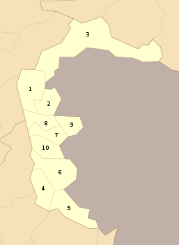 | |
| Muzaffarabad | ||
| Poonch | ||