Baker Lake (Custer County, Idaho)
| Baker Lake | |
|---|---|
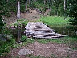 Log bridge at Baker Lake | |
| Location | Custer County, Idaho |
| Coordinates | 44°03′24″N 114°33′51″W / 44.056704°N 114.564083°WCoordinates: 44°03′24″N 114°33′51″W / 44.056704°N 114.564083°W |
| Type | Glacial |
| Primary outflows | Little Boulder Creek to East Fork Salmon River |
| Basin countries | United States |
| Max. length | 630 ft (190 m) |
| Max. width | 509 ft (155 m) |
| Surface area | 7.7 acres (3.1 ha) |
| Surface elevation | 8,468 ft (2,581 m)[1] |
Baker Lake is an alpine lake in Custer County, Idaho, United States, located in the White Cloud Mountains in the Sawtooth National Recreation Area. The name is derived from the fact that the lake is adjacent to mining claims held by the Baker family for many years.[2]
Baker Lake is just east of Merriam Peak and downstream of several other lakes including Castle, Cornice, Emerald, Glacier, Noisy, Quiet, Rock, Scree, and Shallow Lakes. The lake is accessed from Sawtooth National Forest trail 047.[3]
See also
- List of lakes of the White Cloud Mountains
- Born Lakes
- Chamberlain Basin
- Sawtooth National Recreation Area
- White Cloud Mountains
References
- ↑ U.S. Geological Survey Geographic Names Information System: Baker Lake
- ↑ Berringer (January 9, 1973). "Case Brief (Domestic): Baker Lake". BGN Form 7301. Washington DC: United States Board on Geographic Names, Department of the Interior.
- ↑ Sawtooth National Forest. “Sawtooth National Forest” [map].1:126,720, 1”=2 miles. Twin Falls, Idaho: Sawtooth National Forest, United States Forest Service, 1998.
External links
This article is issued from Wikipedia - version of the 12/21/2015. The text is available under the Creative Commons Attribution/Share Alike but additional terms may apply for the media files.