Baldonnel, British Columbia

Baldonnel
Location of Baldonnel in British Columbia
Baldonnel (population ~142) is a town in the Peace River District of British Columbia, Canada, near Fort St. John. It is at an elevation of 680 meters (2,230 ft).
Name
The community gives the name to the gas bearing Baldonnel Formation.
Climate
| Climate data for Baldonnel | |||||||||||||
|---|---|---|---|---|---|---|---|---|---|---|---|---|---|
| Month | Jan | Feb | Mar | Apr | May | Jun | Jul | Aug | Sep | Oct | Nov | Dec | Year |
| Record high °C (°F) | 13.3 (55.9) |
14.4 (57.9) |
18.9 (66) |
29.4 (84.9) |
31.7 (89.1) |
32.2 (90) |
40.6 (105.1) |
34.5 (94.1) |
32.8 (91) |
27.2 (81) |
18.3 (64.9) |
12.2 (54) |
40.6 (105.1) |
| Average high °C (°F) | −7.3 (18.9) |
−5.3 (22.5) |
1.3 (34.3) |
9.8 (49.6) |
16.3 (61.3) |
19.7 (67.5) |
21.9 (71.4) |
20.8 (69.4) |
14.8 (58.6) |
7.8 (46) |
−4.6 (23.7) |
−8.2 (17.2) |
7.2 (45) |
| Daily mean °C (°F) | −11.4 (11.5) |
−9.9 (14.2) |
−3.7 (25.3) |
4.2 (39.6) |
10.2 (50.4) |
13.9 (57) |
15.9 (60.6) |
14.8 (58.6) |
9.5 (49.1) |
3.5 (38.3) |
−8.4 (16.9) |
−12.1 (10.2) |
2.2 (36) |
| Average low °C (°F) | −15.5 (4.1) |
−14.4 (6.1) |
−8.6 (16.5) |
−1.4 (29.5) |
4.0 (39.2) |
8.0 (46.4) |
9.8 (49.6) |
8.8 (47.8) |
4.3 (39.7) |
−0.8 (30.6) |
−12.1 (10.2) |
−15.7 (3.7) |
−2.8 (27) |
| Record low °C (°F) | −48.9 (−56) |
−42.8 (−45) |
−37.2 (−35) |
−32.2 (−26) |
−10.6 (12.9) |
−2.8 (27) |
1.1 (34) |
−2.8 (27) |
−13.9 (7) |
−26.5 (−15.7) |
−40.0 (−40) |
−47.8 (−54) |
−48.9 (−56) |
| Average precipitation mm (inches) | 25.9 (1.02) |
18.5 (0.728) |
17.7 (0.697) |
22.4 (0.882) |
39.7 (1.563) |
70.0 (2.756) |
75.3 (2.965) |
51.3 (2.02) |
43.8 (1.724) |
32.0 (1.26) |
28.1 (1.106) |
25.2 (0.992) |
449.7 (17.705) |
| Average rainfall mm (inches) | 0.3 (0.012) |
0.3 (0.012) |
0.3 (0.012) |
14.2 (0.559) |
36.4 (1.433) |
70.0 (2.756) |
75.3 (2.965) |
51.3 (2.02) |
42.7 (1.681) |
19.1 (0.752) |
2.6 (0.102) |
1.4 (0.055) |
313.9 (12.358) |
| Average snowfall cm (inches) | 25.5 (10.04) |
18.2 (7.17) |
17.4 (6.85) |
8.2 (3.23) |
3.3 (1.3) |
0.0 (0) |
0.0 (0) |
0.0 (0) |
1.0 (0.39) |
12.9 (5.08) |
25.5 (10.04) |
23.8 (9.37) |
135.8 (53.46) |
| Average precipitation days (≥ 0.2 mm) | 9.8 | 9.5 | 7.5 | 8.0 | 10.7 | 12.1 | 13.0 | 12.2 | 11.3 | 10.5 | 11.8 | 10.0 | 126.4 |
| Average rainy days (≥ 0.2 mm) | 0.4 | 0.5 | 0.4 | 5.8 | 10.7 | 12.1 | 13.0 | 12.2 | 11.2 | 6.9 | 1.7 | 0.5 | 75.2 |
| Average snowy days (≥ 0.2 cm) | 9.5 | 9.0 | 7.3 | 3.8 | 0.6 | 0.0 | 0.0 | 0.0 | 0.6 | 4.9 | 10.5 | 9.6 | 55.7 |
| Source: [1] | |||||||||||||
References
- ↑ "Calculation Information for 1981 to 2010 Canadian Normals Data". Environment Canada. Archived from the original on 14 June 2013. Retrieved July 9, 2013.
| Subdivisions | 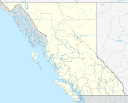 | |
|---|---|---|
| Communities | ||
| Metro areas and agglomerations | ||
| ||
Coordinates: 56°13′02″N 120°41′24″W / 56.21722°N 120.69000°W
This article is issued from Wikipedia - version of the 10/24/2016. The text is available under the Creative Commons Attribution/Share Alike but additional terms may apply for the media files.