Balmaceda, Chile
| Balmaceda | ||
|---|---|---|
| ||
| Coordinates: 45°54′33″S 71°42′02″W / 45.90917°S 71.70056°WCoordinates: 45°54′33″S 71°42′02″W / 45.90917°S 71.70056°W | ||
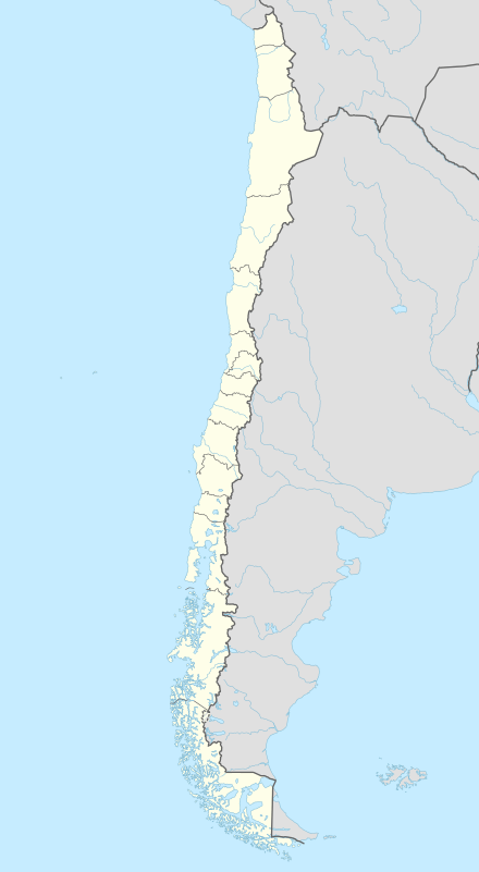
| Country |
| |
| Region | Aysén | |
| Province | Coyhaique | |
| Municipalidad | Coyhaique | |
| Comuna | Coyhaique | |
| Balmaceda | January 1st, 1917 | |
| Government | ||
| • Type | Municipalidad | |
| • Alcade | Alejandro Huala Canumán (2012-2016) | |
| Elevation[1] | 518 m (1,699 ft) | |
| Population (2002 census[2]) | ||
| • Total | 456 | |
| Time zone | Chilean Standard (CLT) (UTC−04:00) | |
| • Summer (DST) | Chilean Daylight (CLST) (UTC−03:00) | |
| Area code(s) | Country + town = 56 + 67 | |
| Climate | Csc | |
Balmaceda is a Chilean village (Spanish: aldea) located south east of Coyhaique in Aysén Region. Balmaceda has around 500 inhabitants, and has Aysén Region's largest airport and meteorological station, Balmaceda Airport. The first settlers arrived into the zone in early-20th century after being expelled from Argentina since the borders between Chile and Argentina were drawn in 1902. In 1917 Balmaceda was officially founded and was named after the Chilean president José Manuel Balmaceda. Balmaceda was initially one of the largest inland Chilean settlements in what is now the Aysén Region.
Climate
The climate of Balmaceda is an unusual combination of the dry-summer Mediterranean characteristic more typical of Central Chile with the subpolar oceanic characteristics more typical of southern Chile. Uniquely to the region surrounding Lago General Carrera,[3] it has the extremely rare cold-summer Mediterranean climate (Köppen Csc), with short, though dry summers, and long, snowy though not severe winters. Precipitation, however, is markedly lower than on the coast of Chile owing to the rain shadow of the Andes, being about one-sixth to one-seventh what is received on the coast at the same latitude. Snow is very common during the winter but rarely stays on the ground.[4]
| Climate data for Balmaceda (extremes 1952–present) | |||||||||||||
|---|---|---|---|---|---|---|---|---|---|---|---|---|---|
| Month | Jan | Feb | Mar | Apr | May | Jun | Jul | Aug | Sep | Oct | Nov | Dec | Year |
| Record high °C (°F) | 33.2 (91.8) |
33.4 (92.1) |
32.0 (89.6) |
24.4 (75.9) |
18.3 (64.9) |
17.2 (63) |
14.5 (58.1) |
15.1 (59.2) |
22.7 (72.9) |
27.8 (82) |
30.0 (86) |
32.0 (89.6) |
33.4 (92.1) |
| Average high °C (°F) | 17.5 (63.5) |
17.7 (63.9) |
15.7 (60.3) |
11.9 (53.4) |
7.8 (46) |
4.3 (39.7) |
3.6 (38.5) |
6.1 (43) |
9.4 (48.9) |
12.6 (54.7) |
14.7 (58.5) |
16.4 (61.5) |
11.5 (52.7) |
| Daily mean °C (°F) | 11.9 (53.4) |
11.4 (52.5) |
9.3 (48.7) |
6.5 (43.7) |
3.4 (38.1) |
0.8 (33.4) |
0.2 (32.4) |
1.9 (35.4) |
4.1 (39.4) |
6.7 (44.1) |
9.2 (48.6) |
10.9 (51.6) |
6.4 (43.5) |
| Average low °C (°F) | 6.7 (44.1) |
6.0 (42.8) |
4.5 (40.1) |
2.6 (36.7) |
0.6 (33.1) |
−2.0 (28.4) |
−2.7 (27.1) |
−1.0 (30.2) |
0.1 (32.2) |
2.1 (35.8) |
4.3 (39.7) |
5.8 (42.4) |
2.3 (36.1) |
| Record low °C (°F) | −4.3 (24.3) |
−7.2 (19) |
−10.3 (13.5) |
−14.6 (5.7) |
−17.3 (0.9) |
−28.3 (−18.9) |
−25.2 (−13.4) |
−20.1 (−4.2) |
−15.8 (3.6) |
−10.0 (14) |
−7.7 (18.1) |
−6.0 (21.2) |
−28.3 (−18.9) |
| Average precipitation mm (inches) | 28.1 (1.106) |
20.4 (0.803) |
37.5 (1.476) |
53.6 (2.11) |
92.5 (3.642) |
85.2 (3.354) |
83.5 (3.287) |
72.2 (2.843) |
49.0 (1.929) |
29.6 (1.165) |
28.3 (1.114) |
31.7 (1.248) |
611.6 (24.077) |
| Average precipitation days | 8 | 5 | 8 | 10 | 15 | 15 | 15 | 13 | 11 | 9 | 8 | 8 | 125 |
| Average relative humidity (%) | 72 | 74 | 77 | 82 | 86 | 87 | 86 | 83 | 79 | 75 | 72 | 72 | 79 |
| Mean monthly sunshine hours | 303 | 266 | 236 | 156 | 117 | 94 | 114 | 161 | 203 | 291 | 292 | 310 | 2,543 |
| Source #1: Dirección Meteorológica de Chile (precipitation and humidity, 1970–2000)[5][6] | |||||||||||||
| Source #2: Información climatológica de estaciones chilenas (temperature and precipitation normals 1961–1990),[7] Deutscher Wetterdienst (sun, 1961–1990)[8][lower-alpha 1][9] | |||||||||||||
Notes
- ↑ Station ID for Balmaceda is 85874 Use this station ID to locate the sunshine duration
References
- ↑ "Balmaceda, Chile". geonames.org. Retrieved 30 November 2016.
- ↑ http://www.ine.cl/canales/chile_estadistico/demografia_y_vitales/demografia/demografia.php
- ↑ World Climate Map
- ↑ Balmaceda Airport Snow depths
- ↑ "Estadistica Climatologica Tomo III (pg 319-343)" (PDF) (in Spanish). Dirección General de Aeronáutica Civil. March 2001. Retrieved January 15, 2013.
- ↑ "Temperatura Mensual Histórica de Estación Balmaceda Ad. (450005)". Sistema de Administración de Datos Climatológicos (in Spanish). Dirección Meteorológica de Chile. Retrieved April 23, 2016.
- ↑ "Datos climatológicos Chile Sur" (in Spanish). Atmosfera.cl. March 2013.
- ↑ "Station 85874: Balmaceda". Global station data 1961–1990—Sunshine Duration. Deutscher Wetterdienst. Retrieved 9 July 2015.
- ↑ http://www.meteochile.gob.cl/climatologia.php