Bampur
| Bampur بمپور | |
|---|---|
| city | |
 Bampur | |
| Coordinates: 27°11′40″N 60°27′21″E / 27.19444°N 60.45583°ECoordinates: 27°11′40″N 60°27′21″E / 27.19444°N 60.45583°E | |
| Country |
|
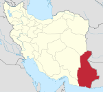
| Province | Sistan and Baluchestan |
| County | Bampur |
| Bakhsh | Central |
| Population (2006) | |
| • Total | 9,073 |
| Time zone | IRST (UTC+3:30) |
| • Summer (DST) | IRDT (UTC+4:30) |
Bampur (Persian: بمپور, also Romanized as Bampūr and Bampoor)[1] is a city in and capital of Bampur County, Sistan and Baluchestan Province, Iran. At the 2006 census, its population was 9,073, in 1,664 families.[2]
Location
It is located 330 miles (530 km) south-east of Kerman at an elevation of 1,720 feet (520 m) In 1911 its population was about 2,000 and it was the capital of the province. It is situated on the banks of the Bampur river which flows from east to west and empties itself about 70 miles (110 km) west into a hamun, or depression, 50 miles (80 km) in length, and called Jaz Murian.[3]
History
The old citadel of Bampur, on a hill about 100 feet (30 m) high 3 miles (4.8 km) north of the river, fell into ruins. A new fort called Kalah Nasseri, was built at Pahrah, which is known as Iranshahr, 15 miles (24 km) further east, in the 1880s.[3]
Fahraj, which in 1911 had a population of about 2,500, has become more important than Bampur. Fahraj, which is also known as Pahura (or Paharu or Puhra), is by some identified as the Poura where Alexander the Great halted on his march from the Indus region of Pakistan.[4]
The majority of the population are ethnic Baloch, who speak the Balochi language.
Archaeology
Bampur is an important site in relation to the ancient Helmand culture of western Afghanistan, and to the closely related Jiroft culture of eastern Iran.[5]
The position of Bampur is near a river and major routes. Thus, prehistoric and later settlements were founded in the area. Sir Aurel Stein carried out reconnaissance here in 1932. In 1966, Beatrice de Cardi excavated next, and she established that there were six successive occupational phases (Periods I-VI) at the site.[6]
There were links with major sites such as Shahr-i Sokhta, and Mundigak.[7]
New ceramics appeared at the end of Period IV, suggesting contact with Iran, Makran, and Oman. Ceramics similar to Shahr-i Sokhta IV (ca. 2200-1800 b.c.) style were introduced in Periods V-VI.[8]
There are also links with Umm an-Nar culture of Oman, dating possibly to the last quarter of the 3rd millennium.
Tepe Yahya in Kerman Province, Iran, is another important site that may be related.
Notes
- ↑ Bampur can be found at GEOnet Names Server, at this link, by opening the Advanced Search box, entering "-3055057" in the "Unique Feature Id" form, and clicking on "Search Database".
- ↑ "Census of the Islamic Republic of Iran, 1385 (2006)". Islamic Republic of Iran. Archived from the original (Excel) on 2011-11-11.
- 1 2
 One or more of the preceding sentences incorporates text from a publication now in the public domain: Chisholm, Hugh, ed. (1911). "Bampūr". Encyclopædia Britannica. 3 (11th ed.). Cambridge University Press. p. 305.
 - ↑ Others are more in favour of another Fahraj near Bam, or even of Bampūr itself as the halting place of Alexander the Great (Chisholm 1911).
- ↑ Jarrige, J.-F., Didier, A. & Quivron, G. (2011) Shahr-i Sokhta and the Chronology of the Indo-Iranian Borderlands. Paléorient 37 (2) : 7-34 academia.edu
- ↑ B. de Cardi, BAMPŪR iranicaonline.org
- ↑ M. Tosi, “Excavations at Shahr-i Sokhta, a Chalcolithic Settlement in the Iranian Sistan: Preliminary Report on the First Campaign, October-December 1967,” East and West, N.S. 18/1-2, 1968, pp. 9-66
- ↑ B. de Cardi, BAMPŪR iranicaonline.org