Ban Rai, Phitsanulok
| Ban Rai บ้านไร่ (English: Farm Village) | |
|---|---|
| Tambon | |
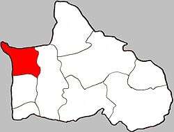 Location of Ban Rai within Amphoe | |
| Coordinates: 16°36′00″N 100°15′00″E / 16.60000°N 100.25000°ECoordinates: 16°36′00″N 100°15′00″E / 16.60000°N 100.25000°E | |
| Country | Thailand |
| Province | Phitsanulok |
| Amphoe | Bang Krathum |
| Population (2005) | |
| • Total | 4,671 |
| Time zone | Thailand (UTC+7) |
| Postal code | 65110 |
| Geocode | 650502 |
| Chief Roadway | Route 1063 |
Ban Rai (Thai: บ้านไร่) is a subdistrict (tambon) in the Bang Krathum district of Phitsanulok Province, Thailand.
(Do not confuse it with Ban Rai, Uthai Thani, which is a district (amphoe) in Uthai Thani Province, Thailand.)
Geography
Ban Rai borders Amphoe Bang Rakam and Wang Nam Khu of Amphoe Mueang Phitsanulok to the north, Bang Krathum to the east, Khok Salut to the south and Phichit Province to the west. Most of Ban Rai lies within the Nan Basin, although a narrow strip of land on the west side of the subdistrict lies within the Yom Basin. Both basins are part of the Chao Phraya Watershed. The Nan River flows through Ban Rai at Ban Khok Salut, and the Yom River forms part of the subdistrict's border with Phichit.
Administration
The subdistrict is subdivided into 10 smaller divisions called (muban), which roughly correspond to the villages in Ban Rai. There are 6 villages, several of which occupy multiple muban. Ban Rai is administrated by a Tambon administrative organization (TAO). The muban in Phai Lom are enumerated as follows: [1]
| No. | English | Thai |
| 1 | Ban Hua Laem | บ้านหัวแหลม |
| 2-3 | Ban Khok Salut | บ้านโคกสลุด |
| 4-7 | Ban Wat Kwang | บ้านวัดขวาง |
| 8 | Ban Hat Tra Goo | บ้านหาดตระกู |
| 9 | Ban Yan Non Prai | บ้านย่านโนนไพร |
| 10 | Ban Kon Apak | บ้านขอนอ้าปาก |
Temples
Ban Rai is home to the following four temples:[2]
- วัดสิริสุทธาวาส in Ban Wat Kwang
- Wat Khok Salut (Ban Khok Salut Village Temple) in Ban Khok Salut
- Wat Prai Soowan (Thai: th:วัดไพรสุวรรณ, Golden Forest Temple) in Ban Yan Non Prai
- วัดราษฎร์ศรัทธาธรรม in Ban Wat Kwang