Barrington Tops State Conservation Area
| Barrington Tops State Conservation Area | |
|---|---|
|
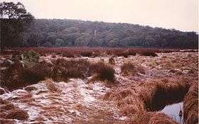
Mount Polblue and Polblue Swamp | |
| Highest point | |
| Coordinates | 31°57.449′S 151°25.704′E / 31.957483°S 151.428400°ECoordinates: 31°57.449′S 151°25.704′E / 31.957483°S 151.428400°E |
| Geography | |
| Location | Barrington Tops, Australia |
| Country | Australia |
| Parent range | Mount Royal Range |
Barrington Tops State Conservation Area is natural area in the Barrington Tops region of eastern Australia. It was previously known as the Polblue and Barrington Tops Crown Reserves. The park was created in January 2003. It covers an area of 8,446 hectares.[1] Unlike the adjacent national park mining is allowed in a State Conservation Area.[2] Zircon, sapphire and rubies were formed from the nearby Barrington Volcano in the Eocene epoch.[3]
References
- ↑ "Barrington Tops State Conservation Area". NSW National Parks & Wildlife Service. Office of Environment & Heritage. Retrieved August 24, 2012.
- ↑ "Barrington Tops National Park, Mount Royal National Park, and Barrington Tops State Conservation Area Plan of Management" (PDF). National Parks & Wildlife Service. NSW Government. Retrieved May 30, 2012.
- ↑ F. L. Sutherland, C. M. Fanning. "Gem‐bearing basaltic volcanism". Barrington, New South Wales: Cenozoic evolution, based on basalt K–Ar ages and zircon fission track and U–Pb isotope dating. Australian Journal of Earth Sciences Vol. 48, Iss. 2, 2001. Retrieved June 2, 2012.
See also
This article is issued from Wikipedia - version of the 12/21/2013. The text is available under the Creative Commons Attribution/Share Alike but additional terms may apply for the media files.