Beers, North Brabant
| Beers | ||
|---|---|---|
| Village | ||
| ||
| Coordinates: 51°43′28″N 5°49′49″E / 51.72444°N 5.83028°E | ||
| Country | Netherlands | |
| Province | North Brabant | |
| Municipality | Cuijk | |
| Population (2013) | 1,721 | |


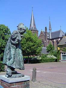
Beers (Brabants: Bèèrs) is a village in the Dutch municipality of Cuijk. It is located about 4 km west of Cuijk. Beers has a population of about 1721: 1305 in the village itself, and 416 in the surrounding countryside, including the hamlets De Plaats and Dommelsvoort.[1]
Until 1994, Beers was a separate municipality.[2]
Toponymy
The name Beers might come from bere or baren, which can mean mud or stuff in Dutch.
History
Beers is first noted in a document that was written between 1050 and 1200. In it beers was named Berse. The family Van Beerse was a vassal from the Lord of Cuijk, making Beers belong to the municipality of Cuijk. This vassal however, did own a small castle surrounded by a moat, named De Broekhof.
Around 1814, at the end of the French age and at the beginning of the Kingdom of the Netherlands, Beers became a separate municipality. In 1942, Great-Linden and Gassel joined Beers. In 1994 the municipality of Beers was repealed. Gassel joined the municipality of Grave, North Brabant, while Beers and Great-Linden (today Linden, North Brabant) joined Cuijk. This remained to the present day.
References
- ↑ Statistics Netherlands, 2007. Figures are for the year 2006. Statistics are available in Google Earth format. Statistical areas "Beers" and "Verspreide huizen Beers".
- ↑ Ad van der Meer and Onno Boonstra, Repertorium van Nederlandse gemeenten, KNAW, 2006.
External links
- J. Kuyper, Gemeente Atlas van Nederland, 1865-1870, "Beers". Map of the former municipality, around 1868.
Coordinates: 51°43′33″N 5°49′40″E / 51.72583°N 5.82778°E