Bernstorff Fjord
| Bernstorff Fjord Kangertittivaq | |
|---|---|
| Bernstorff Isfjord | |
 Location | |
| Location | Arctic |
| Coordinates | 63°42′N 41°10′W / 63.700°N 41.167°WCoordinates: 63°42′N 41°10′W / 63.700°N 41.167°W |
| Ocean/sea sources | North Atlantic Ocean |
| Basin countries | Greenland |
Bernstorff Fjord (Danish: Bernstorff Isfjord; Greenlandic: Kangertittivaq)[1] is a fjord in King Frederick VI Coast, eastern Greenland.
Administratively it is part of the Sermersooq municipality. The fjord was named after Danish statesman Andreas Peter Bernstorff. This fjord is almost always blocked by heavy ice.[2]
History
One of the coastal islands, Igdluluarssuk (Sattiaatteq) at the entrance of the fjord on its southern side, had had the northernmost Inuit settlement of the southern group on the east coast in the recent past.[3]
Arctic explorer Wilhelm August Graah of the Danish Navy explored this area in 1828–30, during an expedition in search of the legendary Eastern Norse Settlement.[4]
Geography
To the east the Bernstorff Fjord opens into the North Atlantic Ocean. It separates the Odinland Peninsula to the north, from the Thorland Peninsula to the south of the fjord.[5] A single island, Ensomheden, is located within the fjord about 33 kilometres (21 miles) from its mouth.[6] Cape Mosting is the headland on the northern side.[2]
The Storebjorn, Bernstorff, Fimbul and Sleipner glaciers at the head of this fjord produce massive amounts of ice.[7] The constant glacier activity produces a powerful current streaming out of the fjord which, together with the numerous ice floes, makes navigation hazardous in the area between its mouth and Umivik Bay.
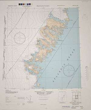 1944 map of the area around Skjoldungen. |
See also
Bibliography
- Spencer Apollonio, Lands That Hold One Spellbound: A Story of East Greenland, 2008
References
- ↑ Den grønlandske Lods - Geodatastyrelsen
- 1 2 Prostar Sailing Directions 2005 Greenland and Iceland Enroute, p. 102
- ↑ Encyclopedia Arctica 15: Biographies - Gustav Frederick Holm
- ↑ Graah, W. A. (1832). Undersøgelses-Reise til Østkysten af Grønland, efter kongelig Befaling udført i Aarene 1828-31 [Exploration of the East Coast of Greenland, by royal order executed in the years 1828-31] (in Danish). Copenhagen.
- ↑ "Bernstorff Isfjord". Mapcarta. Retrieved 8 April 2016.
- ↑ "Ensomheden". Mapcarta. Retrieved 8 April 2016.
- ↑ Evidence for the asynchronous retreat of large outlet glaciers in southeast Greenland at the end of the last glaciation
External links
- Picture of Ensomheden in the middle of Bernstorff Fjord
- Seabirds and seals in Southeast Greenland; Results from a survey in July 2014