Berriane
| Berriane بريان | |
|---|---|
| Commune and town | |
 Location of Berriane commune within Ghardaïa Province | |
 Berriane Location of Berriane within Algeria | |
| Coordinates: DZ 32°50′N 3°46′E / 32.833°N 3.767°ECoordinates: DZ 32°50′N 3°46′E / 32.833°N 3.767°E | |
| Country |
|
| Province | Ghardaïa Province |
| District | Bérianne District (coextensive) |
| Area | |
| • Total | 2.25 km2 (0.87 sq mi) |
| Elevation | 539 m (1,768 ft) |
| Population (2008)[1] | |
| • Total | 30,200 |
| Time zone | CET (UTC+1) |
Berriane (from Tamazight: Bergan) (Arabic: بريان) is a medium-sized town and commune in the south of Algeria, coextensive with Bérianne District, in Ghardaïa Province, Algeria. It is located in the north of the Sahara desert, in the extreme North of the wilaya of Ghardaïa, 554 kilometres (344 mi) south of Algiers and 43 kilometres (27 mi) north of Ghardaïa City. As of the 2008 census it has a population of 30,200,[1] up from 24,802 in 1998,[2] with an annual growth rate of 2.0%.[1] It occupies an area of 2.250 km².
History
Archaeological, prehistoric and historical testimonies indicate that the area of Berriane was inhabited since at least the Neolithic era. The population of Berriane are principally of Zenata origin, who are descended from Garamantes Berber ancestors.
The town of Berriane forms an integral part of the history of the area of M'zab. It is chronologically the youngest of all the cities of the M'zab region.
Recent events
Although an ancient Berber town, with a majority Zenata Ibadi population, in recent years many Chaambi (Bedouin) Arabs have settled there. In March 2008 and February 2009 it was the scene of heavy riots between Berbers and Arabs,[3] in which at least 4 native Berbers were killed.
Geography
In addition to its regional importance from the demographic, economic and cultural point of view, the commune of Berriane occupies a strategic position, connecting the cities of the South to those of the North.
Its green palm grove forms a beautiful oasis which offers to its urban environment a more pleasant microclimate in an area characterized by an arid climate.
Climate
Berriane has a hot desert climate (Köppen climate classification BWh), with very hot summers and mild winters, and very little precipitation throughout the year.
| Climate data for Berriane | |||||||||||||
|---|---|---|---|---|---|---|---|---|---|---|---|---|---|
| Month | Jan | Feb | Mar | Apr | May | Jun | Jul | Aug | Sep | Oct | Nov | Dec | Year |
| Average high °C (°F) | 15.5 (59.9) |
18.2 (64.8) |
21.4 (70.5) |
26.9 (80.4) |
31.6 (88.9) |
37 (99) |
41.6 (106.9) |
40.3 (104.5) |
33.9 (93) |
26.5 (79.7) |
20 (68) |
16.1 (61) |
27.42 (81.38) |
| Daily mean °C (°F) | 9.6 (49.3) |
11.7 (53.1) |
14.6 (58.3) |
19.2 (66.6) |
23.6 (74.5) |
28.8 (83.8) |
32.8 (91) |
31.8 (89.2) |
26.9 (80.4) |
19.9 (67.8) |
13.9 (57) |
10.2 (50.4) |
20.25 (68.45) |
| Average low °C (°F) | 3.7 (38.7) |
5.2 (41.4) |
7.9 (46.2) |
11.5 (52.7) |
15.7 (60.3) |
20.7 (69.3) |
24.0 (75.2) |
23.3 (73.9) |
19.9 (67.8) |
13.4 (56.1) |
7.8 (46) |
4.3 (39.7) |
13.12 (55.61) |
| Average precipitation mm (inches) | 8 (0.31) |
6 (0.24) |
11 (0.43) |
8 (0.31) |
6 (0.24) |
4 (0.16) |
1 (0.04) |
6 (0.24) |
8 (0.31) |
9 (0.35) |
9 (0.35) |
8 (0.31) |
84 (3.29) |
| Source: climate-data.org[4] | |||||||||||||
Transportation
Berriane is crossed by the National Road 01, one of the country's important communication lines, and part of the Trans-Sahara Highway. The road leads north to Laghouat and Djelfa, and south to Ghardaïa, In Salah and Tamanrasset.
Culture
Berriane is known for its pretty handicraft carpets and its artisanal products manufactured by highly qualified creators. It is also known for its folklore, culture heritage, ancestral culinary art and architecture.
Economy
In addition its agricultural economy centered around date palms, Berriane is also an attractive city for tourists, featuring engravings and rock frescos dating from prehistory, inscriptions in the Tamazight alphabet called Tifinagh, and historic buildings and architecture similar to other cities of the internationally famous M'Zab. The M'Zab region has classified by UNESCO as a world cultural heritage on its World Heritage List.[5]
Education
6.3% of the population has a tertiary education, and another 15.3% has completed secondary education.[6] The overall literacy rate is 88.3% (the second highest in the province), and is 93.3% among males and 83.2% among females (also the second highest in the province).[7]
Localities
The commune of Berriane is composed of two localities:[8]
- Vieux Ksar de Berriane
- Quartiers périphériques et Palmeraie
References
- 1 2 3 "Population: Ghardaïa Wilaya" (PDF) (in French). Office National des Statistiques Algérie. Retrieved 12 February 2013.
- ↑ "Algeria Communes". Statoids. Retrieved 9 March 2013.
- ↑ Arab-Berber clashes shake Algeria town, Lamine Chikhi, Reuters. 18 May 2008.
- ↑ "Climate data for: Berriane". climate-data.org. Retrieved 27 March 2013.
- ↑ "M'Zab Valley". UNESCO. Retrieved 13 February 2013.
- ↑ "Structure relative de la population résidente des ménages ordinaires et collectifs âgée de 6 ans et plus selon le niveau d'instruction et la commune de résidence." (PDF) (in French). Office National des Statistiques Algérie. Retrieved 13 February 2013.
- ↑ "Taux d'analphabétisme et taux d'alphabétisation de la population âgée de 15 ans et plus, selon le sexe et la commune de résidence ." (PDF) (in French). Office National des Statistiques Algérie. Retrieved 13 February 2013.
- ↑ "Décret n° 84-365, fixant la composition, la consistance et les limites territoriale des communes. Wilaya d'El Oued" (PDF) (in French). Journal officiel de la République Algérienne. 19 December 1984. p. 1578. Archived from the original (PDF) on 2 March 2013 or before. Retrieved 2 March 2013. Check date values in:
|archive-date=(help)
 |
Laghouat Hassi R'Mel (Laghouat) |
Hassi Delaa (Laghouat) | | |
| El Bayadh | |
El Guerrara | ||
| ||||
| | ||||
| Ghardaia | Zelfana |
Capital: Ghardaïa | ||
| Ghardaïa District | 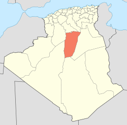 | |
| Bérianne District | ||
| Bounoura District | ||
| Dhayat Ben Dhahoua District | ||
| El Guerrara District | ||
| El Ménia District | ||
| Mansourah District | ||
| Métlili District | ||
| Zelfana District | ||