Big Hill Lake
| Big Hill Lake | |
|---|---|
 | |
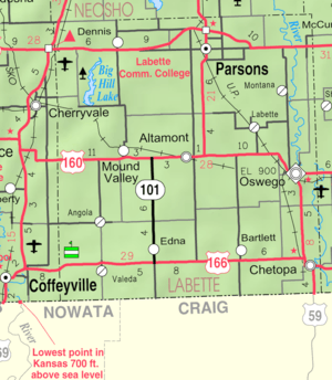 KDOT map of Labette County (legend) | |
| Location | Labette County, Kansas |
| Coordinates | 37°16′07″N 95°28′09″W / 37.26861°N 95.46917°WCoordinates: 37°16′07″N 95°28′09″W / 37.26861°N 95.46917°W |
| Type | Reservoir |
| Primary inflows | Big Hill Creek |
| Primary outflows | Big Hill Creek |
| Basin countries | United States |
| Managing agency | U.S. Army Corps of Engineers |
| Surface area | 1,240 acres (500 ha) |
| Settlements | Cherryvale, Parsons, Mound Valley, Dennis |
| References | [1] |
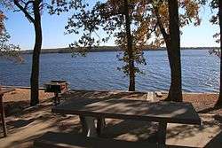
Big Hill Lake is a body of water in Labette County, Kansas, United States. It is located 3.5 miles (5.6 km) east of Cherryvale and 9.5 miles (15.3 km) southwest of Parsons. The reservoir holds 1,240 acres (5.0 km²) of water, with 367 acres (1.49 km2) available for public use. Fishing, picnicking, boating, and a sandy beach swimming area are popular activities. The lake is operated by the U.S. Army Corps of Engineers.
See also
References
| Wikimedia Commons has media related to Big Hill Lake. |
This article is issued from Wikipedia - version of the 3/16/2016. The text is available under the Creative Commons Attribution/Share Alike but additional terms may apply for the media files.