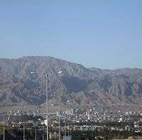
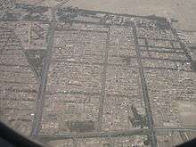
Birjand
| Birjand بیرجند (Persian) | |
|---|---|
 | |
| Nickname(s): City of Pines, City of Culture | |
 Birjand | |
| Coordinates: 32°52′N 59°12′E / 32.867°N 59.200°ECoordinates: 32°52′N 59°12′E / 32.867°N 59.200°E | |
| Country |
|
| Province | South Khorasan |
| County | Birjand |
| Bakhsh | Central |
| First mention | 13th century |
| Elevation | 1,491 m (4,892 ft) |
| Population (2012) | |
| • City | 179,686 |
| • Density | 3,697/km2 (9,580/sq mi) |
| • Urban | 302,168 |
| • Metro | 248,623 |
| Time zone | IRST (UTC+3:30) |
| • Summer (DST) | IDST (UTC+4:30) |
| Area code(s) | (+98) 56 |
| Website | www.birjand.ir/ |
| Prefix code: +98 Iran - (0)561 Birjand | |
Birjand (Persian: بیرجند ![]() pronunciation , also Romanized as Bīrjand and Birdjand)[1] is the east Iranian provincial capital of South Khorasan and the centre of the county Birjand resp. Quhestan, known for its saffron, barberry, rug and handmade carpet exports.
[2]
The city of Birjand had a population of 187,020 people at the time of the last official census in 2013.[3]
pronunciation , also Romanized as Bīrjand and Birdjand)[1] is the east Iranian provincial capital of South Khorasan and the centre of the county Birjand resp. Quhestan, known for its saffron, barberry, rug and handmade carpet exports.
[2]
The city of Birjand had a population of 187,020 people at the time of the last official census in 2013.[3]
Being close to the Afghanistan border, Birjand is located on the "Silk Road" of opium smuggled from Afghanistan on the way to Europe (also dubbed the "opium crescent").
The city has a dry climate with significant difference between day and night temperatures. It is a fast-growing city, thus becoming one of the major centres in the East of Iran.
History
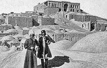
The first citation of the city in the historical literature belongs to the famous book Mojem Alboldan, by Yaqut Homavi (13th century) which introduces the Birjand as the most beautiful town in the Qohestan. Before this, Birjand had been probably not as big and important as a municipality but rather as a rural community. However, the Birjand geographical area had its historical and political importance long before the emergence of the city of Birjand. Many citations of the region are available in the original literature like Ehya -ol- Molook of the once important localities in the area. Apart from literature, the oldest evidence on the history of the region is the ancient Lakh-Mazar inscription in the Kooch village some 25 km (16 mi) south east of Birjand. Numerous fine drawings and inscriptions are carved on an igneous rock surface. The inscriptions include pictograms as well as Arsacid Pahlavi, Sasanian Pahlavi, Arabic and Persian scripts.[4] The former tribe famous for the region of Birjand is called Sagarthian - historically in union with the Parthian.
Birjand has emerged as the centre of Qohestan, following the decline of historical city of Qaen in the Safavid period. Since then the Alam clan had ruled the region till the end of Qajar dynasty. During the semi-autonomous ruling of Alam clan, Great Britain and Russia established consular branches in Birjand, because of the important geographical location of the region in the vicinity of the Indian subcontinent. Amir Shokat Ul-Molk Alam, the father of the Asadollah Alam(once prime minister of Iran) was still ruling the Qohestan's subprovince Qhaenat into the Pahlavi era. And the last tribal leader of Birjand Shah Seyyed Ali Kazemi was related with the Alam clan and the emperor Reza Shah Pahlavi. However Birjand lost its geopolitical importance following the emergence of Reza Shah Pahlavi and his policy of central government.
The entire Qohestan region then became a part of the modern Khorasan province. The local people, however, started a movement to become an independent province at the middle of the second Pahlavi period. The move resulted after about forty years and Quhestan and particularly Birjand regained their historical importance in 2004, after the official division of Khorasan to three smaller provinces by the Iranian government.
Climate
Birjand has a cold desert climate (Köppen climate classification BWk) with hot summers and cool winters. Precipitation is low, and mostly falls in winter and spring.
| Climate data for Birjand | |||||||||||||
|---|---|---|---|---|---|---|---|---|---|---|---|---|---|
| Month | Jan | Feb | Mar | Apr | May | Jun | Jul | Aug | Sep | Oct | Nov | Dec | Year |
| Record high °C (°F) | 25.0 (77) |
27.0 (80.6) |
32.0 (89.6) |
36.0 (96.8) |
40.0 (104) |
43.0 (109.4) |
44.0 (111.2) |
42.0 (107.6) |
39.2 (102.6) |
36.0 (96.8) |
29.0 (84.2) |
25.0 (77) |
44 (111.2) |
| Average high °C (°F) | 11.0 (51.8) |
13.1 (55.6) |
18.8 (65.8) |
24.7 (76.5) |
30.6 (87.1) |
35.2 (95.4) |
35.6 (96.1) |
34.3 (93.7) |
31.7 (89.1) |
26.6 (79.9) |
19.7 (67.5) |
13.4 (56.1) |
24.6 (76.2) |
| Daily mean °C (°F) | 4.0 (39.2) |
6.2 (43.2) |
11.7 (53.1) |
17.6 (63.7) |
23.3 (73.9) |
27.9 (82.2) |
28.8 (83.8) |
26.8 (80.2) |
23.1 (73.6) |
17.5 (63.5) |
10.8 (51.4) |
5.8 (42.4) |
16.96 (62.52) |
| Average low °C (°F) | −2.3 (27.9) |
−0.3 (31.5) |
4.4 (39.9) |
9.6 (49.3) |
13.9 (57) |
17.9 (64.2) |
19.7 (67.5) |
17.1 (62.8) |
12.1 (53.8) |
7.3 (45.1) |
2.2 (36) |
−1.2 (29.8) |
8.4 (47.1) |
| Record low °C (°F) | −16.5 (2.3) |
−14.7 (5.5) |
−12 (10) |
−4.5 (23.9) |
0.0 (32) |
7.0 (44.6) |
10.2 (50.4) |
6.6 (43.9) |
1.0 (33.8) |
−5.6 (21.9) |
−11 (12) |
−15.8 (3.6) |
−16.5 (2.3) |
| Average precipitation mm (inches) | 31.3 (1.232) |
32.4 (1.276) |
35.1 (1.382) |
31.6 (1.244) |
7.1 (0.28) |
0.3 (0.012) |
0.1 (0.004) |
0.2 (0.008) |
0.0 (0) |
2.6 (0.102) |
8.4 (0.331) |
19.7 (0.776) |
168.8 (6.647) |
| Average rainy days | 7.9 | 8.3 | 9.2 | 8.0 | 3.6 | 0.7 | 0.4 | 0.2 | 0.3 | 1.6 | 3.3 | 6.3 | 49.8 |
| Average snowy days | 2.6 | 1.7 | 0.3 | 0.2 | 0 | 0 | 0 | 0 | 0 | 0 | 0.1 | 1.1 | 6 |
| Average relative humidity (%) | 57 | 55 | 46 | 38 | 27 | 21 | 21 | 22 | 22 | 28 | 39 | 52 | 35.7 |
| Mean monthly sunshine hours | 196.3 | 188.3 | 211.4 | 231.8 | 303.4 | 334.8 | 347.2 | 349.3 | 298.2 | 286.0 | 229.6 | 195.8 | 3,172.1 |
| Source: NOAA (1961–1990) [5] | |||||||||||||
Education
It is said that the Shokatiyeh School in Birjand together with Darolfonoon in Tehran were the first modern public schools of higher education in Iran in the mid-19th century. Ever since then, Birjand has amassed an abundance of institutions of higher education and become an important location for research and development.
The city contains such universities and academic institutions as:
- University of Birjand[6]
- Birjand University of Technology[7]
- Birjand University of Medical Sciences[8]
- Payame Noor University[9]
- Islamic Azad University of Birjand[10]
- University of Applied Science and Technology (south khorasan branch)
- Academy of Tarbiat-e Moalem
- Academy of Amuzesh-e Aly
- Academy of Amuzesh-e Modiriat Dolaty
Birjand Airport
Birjand Airport is located in a suburban region of Birjand. Due to the geopolitical eminence of Birjand in the eastern parts of Iran, Birjand Airport began operating in 1933 as the 3rd airport in Iran. Birjand Airport offers non-stop daily flights to Tehran and Mashhad. It became an international airport after the first international flight to Medina, Saudi Arabia in June 2008. In October 2009, runway 10/28 was closed for fundamental repair. The runway was strengthened, re-carpeted and extended to 4000 meters to accommodate wide-body aircraft. During the construction phase all flights were suspended while Aseman Airline utilized the older runway (08/26) and began offering daily flights to Tehran.
Notable people
- Abd al-Ali al-Birjandi, 16th century astronomer
- Eftekhar Eftekharpour PhD
- Hakim Nezari Quhestani
- Ibn Hessam Khusfi
- Amir Shokat Ul-Molk Alam, Amir of Qaen County and Governor of Quhestan at the end of Qajar Dynasty
- Amir Ali Khan Sheibany, PhD, founder and first CEO of Zob Ahan Esfahan (Esfahan Steel Company)
- Seyyed Mohammad Tadayyon
- Asadollah Alam, prime minister of Iran during Pahlavi dynasty
- Seyyed Gholam Reza Saeidi, writer
- Mohamad Haghgou, composer
- Sima Bina, Iranian folk music singer
- Ahmad Kamyabi Mask, writer and renowned theater scholar
- Morteza Hassanpour, first Iranian male nurse
- Mohammad Hassan Ganji, geographer
- Mohammad Ismail Rezvani, historian
- Mohammad Reza Hafeznia
- Gholam Hossein Shokouei
- Kazem Motamadnejad
- Shah Seyyed Ali Kazemi, Last tribal leader in Mood and Birjand at the beginning of Pahlavi Dynasty
- Mohammad Hossain Ayati
- Mohammad Ibrahim Ayati
- Seyyed Hassan Tahami
- Ardalan Shoja Kaveh, actor
See also
References
- ↑ Birjand can be found at GEOnet Names Server, at this link, by opening the Advanced Search box, entering "-3056455" in the "Unique Feature Id" form, and clicking on "Search Database".
- ↑ "Cities in Iran: 2005 Population Estimates". Mongabay.com.
- ↑ "Archived copy". Archived from the original on 2007-12-11. Retrieved 2016-02-06.
- ↑ Research articles collection (archaeology, ancient inscriptions): Lakh-Mazar, Birjand. Rajab Ali Labbaf Khaniki, Rassul Bashash Kanzaq. 25. Iranian Cultural Heritage Organization. Summer 1994.
- ↑ "Birjand Climate Normals 1961–1990". National Oceanic and Atmospheric Administration. Retrieved December 29, 2012.
- ↑ http://www.birjand.ac.ir
- ↑ http://www.birjandut.ac.ir
- ↑ http://www.bums.ac.ir/
- ↑ http://www.skpnu.ac.ir
- ↑ "Archived copy". Archived from the original on 2006-08-24. Retrieved 2006-07-28.
External links
| Wikimedia Commons has media related to Birjand. |
- All About Birjand
- About Birjand: The Capital of Saffron Province
- Cultural Heritage and Tourism Organisation General Office
- University of Birjand
- Birjand University of Medical Sciences
- Birjand University of Technology
- birjand sama college
| Capital |  | ||||||||||||||||||||||||||||||||||||||||||
|---|---|---|---|---|---|---|---|---|---|---|---|---|---|---|---|---|---|---|---|---|---|---|---|---|---|---|---|---|---|---|---|---|---|---|---|---|---|---|---|---|---|---|---|
| Counties and cities | |||||||||||||||||||||||||||||||||||||||||||
| Sights |
| ||||||||||||||||||||||||||||||||||||||||||
| populated places | |||||||||||||||||||||||||||||||||||||||||||