Bláhnjúkur
| Bláhnjúkur | |
|---|---|
 Bláhnjúkur, 2004 | |
| Highest point | |
| Elevation | 940 m (3,080 ft) |
| Coordinates | 63°58′36″N 19°04′05″W / 63.9768°N 19.0681°WCoordinates: 63°58′36″N 19°04′05″W / 63.9768°N 19.0681°W |
| Naming | |
| Translation | Blue mountain (Icelandic) |
| Geography | |
 Bláhnjúkur | |
| Geology | |
| Mountain type | Volcano |
| Climbing | |
| Easiest route | Hike |
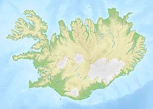
Bláhnjúkur is a volcano in the south of Iceland. Its height is 940 m.[1]
Its name translates to blue peak in English.[2] This comes from the blue-black colour of its sides. The colour is due to volcanic ash and lava flows.[3]
The mountain is situated in Landmannalaugar,[4] a natural park near Hekla. It lies next to the volcano Brennisteinsalda.
A hiking trail leads up to the top of the mountain from which, in good conditions, five glaciers are visible.[3]
The best way to get to the peak is on road number F 208. The hike is considered easy and takes 1-2 hours round-trip.[4]
References
- ↑ "Bláhnjúkur – Climbing, Hiking & Mountaineering". Mountain Forecast. Retrieved 20 September 2016.
- ↑ "Hiking Iceland: Bláhnjúkur". Out and About with the GeoKs. 24 August 2015. Retrieved 20 September 2016.
- 1 2 "Information about Bláhnjúkur". Guide to Iceland. Retrieved 20 September 2016.
- 1 2 "Bláhnjúkur". Iceland Trails. Retrieved 20 September 2016.
See also
External links
| Wikimedia Commons has media related to Bláhnjúkur. |
This article is issued from Wikipedia - version of the 9/20/2016. The text is available under the Creative Commons Attribution/Share Alike but additional terms may apply for the media files.