Blackmore River
| Blackmore | |
| River | |
| Country | Australia |
|---|---|
| Territory | Northern Territory |
| Source | |
| - location | Wild Horse Plain, Australia |
| - elevation | 21 m (69 ft) |
| Mouth | |
| - location | Darwin Harbour, Australia |
| - elevation | 0 m (0 ft) |
| - coordinates | 12°38′27″S 130°57′03″E / 12.64083°S 130.95083°ECoordinates: 12°38′27″S 130°57′03″E / 12.64083°S 130.95083°E |
| Length | 25 km (16 mi) |
| Basin | 848 km2 (327 sq mi) |
 | |
| [1] | |
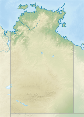
Blackmore River flows into Darwin Harbour close to Darwin in the Australian Northern Territory.[2]
Course
The headwaters of the river rise at an elevation of 21 metres (69 ft) on the Wild Horse Plain and flow northwards past Tumbling Waters and through the Blackmore River Conservation Reserve. The river eventually discharges into Port Darwin and then the Timor Sea.
The Elizabeth River and Blackmore River catchments together occupy an area of 1,150 square kilometres (444 sq mi),[3] with the Blackmore catchment occupying 848 square kilometres (327 sq mi).
The estuary formed at the river mouth is tidal in nature and in near pristine condition.[4]
Climate
The climate of the Blackmore River region is monsoon tropical with two distinct seasons: the Dry and the Wet. The Dry lasts for 6 months between April and September with an average rainfall of 24 mm, whereas the Wet lasts between October and March with an average monthly rainfall of 254 mm/month (according to the Bureau of Meteorology, 1999). The majority of the rain falls between December and April. Runoff varies between 250–1000 mm.
Peak flow for the Blackmore River occurs in February with 605Ml/day, after which it slowly decreases until July when there is no freshwater input into Darwin Harbour until the onset of the following wet season (Padovan 1997). Cyclone frequency is low to moderate.[2]
Water quality
The water quality at the upper estuary and freshwater monitoring sites of the Department of Land Resource Management of the Northern Territory Government was 2011 in moderate condition.[5]
Geology
The underlying lithology is dominated by Permian siltstones and sandstones.[2]
See also
References
- ↑ "Map of Blackmore River, NT". Bonzle Digital Atlas of Australia. Retrieved 18 May 2015.
- 1 2 3 N Smit, R Billyard and L Ferns: Beagle Gulf Benthic Survey: Characterisation of soft substrates. Technical Report No. 66 (2000), Parks and Wildlife Commission of the Northern Territory.
- ↑ "Elizabeth & Blackmore River Catchments - Flood Study" (PDF). Cardno. 11 April 2014. Retrieved 18 May 2015.
- ↑ "Australian Catchment, River and Estuary Assessment" (PDF). Natural Heritage Trust. 2002. Retrieved 19 May 2015.
- ↑ Blackmore River and Estuary Archived April 1, 2015, at the Wayback Machine.
River systems and rivers of the Northern Territory, Australia | |
|---|---|
| Floodplains | |
| Rivers |
|
| |