Juan de Fuca Provincial Park
Juan de Fuca Provincial Park is a provincial park in British Columbia, Canada. The park was created in 1996 by combining the former China Beach Provincial Park, Loss Creek Park, Parkinson Creek Park and Botanical Beach Park and the trail connecting them into one park.[1]
History
The park was established April 4, 1996. The region is so biologically significant that Josephine Tilden of the University of Minnesota installed the first marine research station in the Pacific Northwest at Botanical Beach in 1901. The University had a station here for a few years but they left in 1906. Conway MacMillan resigned after the university refused to take ownership of land in a different country. Since then, the area has been used for research by a number of universities in BC and Washington.
Geography
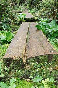
The park has an area of 15.28 km². The Juan de Fuca Marine Trail was originally part of a lifesaving trail that serviced this area, known at the time as the Graveyard of the Pacific. It has been upgraded and maintained over the years and is now a very popular 47 km hiking trail, very similar to the West Coast Trail in Pacific Rim National Park.
The park is located 35 kilometres west of Sooke and 36 kilometres east of Port Renfrew, British Columbia.
Conservation
The primary role of Juan de Fuca Provincial Park is to protect a highly scenic and unique shoreline area between Sooke and Port Renfrew along the Strait of Juan de Fuca. The park encompasses a wide spectrum of natural values from forests to wildlife that must be protected and managed to reflect the purpose for which it was created. Juan de Fuca Provincial Park provides a protected habitat and natural corridor for many larger species of west coast mammals such as cougar, deer, black bear, wolf, otter, seal and sea lions. Red, purple and orange starfish and sea urchins, white gooseneck barnacles, blue mussels and green sea anemones and sea cucumbers only begin to hint at the colourful spectrum of intertidal life thriving here.
Recreation
The following recreational activities are available: vehicle accessible and wilderness camping, hiking, picnicking, interpretive walks, swimming, canoeing and kayaking, fishing, SCUBA diving, windsurfing, and surfing. The beach is best visited at low tide.
See also
References
External links
- Juan de Fuca Provincial Park at BC Parks
- JuandeFucaMarineTrail.com
- Provincial Park (Botanical Beach)
- Pictures of Tidepools on the beach
- Tide Tables
Coordinates: 48°29′00″N 124°17′00″W / 48.48333°N 124.28333°W