Thames Ditton Island
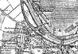
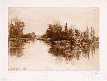
Coordinates: 51°23′40″N 0°19′55″W / 51.39444°N 0.33194°W Three islands form a linear group by the riverside at the end of the historic main street of Thames Ditton, in the River Thames in Surrey, on the Kingston reach above Teddington Lock. Thames Ditton Island, the largest of the three, is 350 yards (320 m) long and has 47 homes with gardens (moorings). Boyle Farm Island has a single house and Swan Island, between the two, is the smallest.
History


Henry VIII lived at Hampton Court long before there were any locks; these reached Teddington from upriver by 1810. The River Thames was then tidal and Kingston Bridge was the only bridge above Putney Bridge and below Chertsey Bridge.[1] As there was no Hampton Court Bridge, a usual way to Hampton Court from the south-west of Surrey and thereabouts was by carriage or cart, northwards down Thames Ditton High Street, over what is now a public slipway where the river is wide, and at low tide straight through the ford to the other side. When the tide was in, ferrymen would charge a groat or two.[2]
Travelling from London to Hampton Court, instead of using Kingston Bridge the monarch would often be rowed up from Westminster to the palace.[2] The last stretch of the river to the palace was a notably narrower, more twisting creek, especially at low tide at times of lower rainfall. To effect a grander arrival and alleviate flooding of the village, the river was dug out straight, thus leaving the islands separated from the grounds of Hampton Court on the north bank (in Middlesex). Before locks and weirs controlled the levels, Summer Road in Thames Ditton would flood at most high tides – its mud would not dry in the winter months, making it impassable, hence its name.[2]
The first wooden bridge over the river at Hampton Court opened in 1753[3] and had a toll collected by a bridge-keeper. A ferry remained at the Swan Inn near the islands until at least 1911, and charged less than the toll.[1][4] The original rather rickety bridge was replaced by a more substantial timber one in 1778. In 1865 this was replaced by a steel and brick bridge, and in 1933 this was in turn replaced by the existing concrete structure. The Thames locks began to appear late in the 18th century, 'Moulsey' (today called Molesey) was built in 1815.[2]
Boyle Farm was in the 19th century the property of the 1st Lord St Leonards (1781—1875), a jurist (legal researcher and publisher), barrister, and Lord Chancellor.[4] Until the 20th century Thames Ditton Island was part of Middlesex, and then of Greater London from 1965.[5] The residents petitioned Middlesex County Council in 1930, requesting to be transferred from Middlesex to Surrey.[6] The island was finally transferred from the London Borough of Richmond upon Thames, Greater London to Esher Urban District, Surrey on 1 April 1970.[7]
Historic use
For many centuries the island formed part of the lands of the Manor of Imworth (Imber) appurtenant to land that became Forde's Farm and later Boyle Farm. In a survey of the manor of Imber in 1608 the island was known as Colly's Eite (Ait or Eyot meaning a small island) and is recorded as '2 acres of pasture'. On the Surrey bank opposite, where the Swan Inn was built, the slipway and nearby wharf provided a useful dock for the passage of goods and people up and down the river. Large sailing barges from the Port of London would moor here to load or unload, their crews and attendant waggoners taking rest and sustenance at the inn.[2]
The island was then not much more than a muddy hump, but the skiffs of the day trippers from Kingston would be moored there to allow their occupants to enjoy a riverside picnic. In the early 20th century came a fad for riverside weekend bungalows: the idea spread and a number of holiday chalets were built on the island. Life there must have been a matter of indoor camping, as there were no facilities of any kind: water and paraffin had to ferried over in cans, and only the smarter sheds had a roof over the earth closet.[2]
As time passed, the attractions of the waterside location drew more and more people, so that by 1930 the whole of the perimeter was covered in wooden bungalows, with the owners' boats moored at the bottom of their gardens. The building of the suspension bridge in 1939 by David Rowell & Co. really opened up the island as a place for permanent occupation by providing passage on foot, carrying water, electricity and gas in, and enabling installation of WCs by transferring sewage out to the town drains. Originally leased from the island's owner, the publican at the Olde Swan, by 1963 all the houses had passed into freehold ownership and a limited company was formed to take over the bridge and adjacent gardens and to provide maintenance services.[2]
Boyle Farm Island
Boyle Farm Island is the second largest of the three islands. (51°23′33.5″N 0°19′47″W / 51.392639°N 0.32972°W) It contains a single house, home to just one family. It is directly opposite the historic mansion of Boyle Farm, which is now known as the Home of Compassion. Whereas its larger partner, Thames Ditton Island, was part of Middlesex and then Greater London, Boyle Farm Island has always belonged to Surrey.
Swan Island
Swan Island is the smallest of the three islands. (51°23′34.5″N 0°19′50″W / 51.392917°N 0.33056°W) On it was once the ferryman's hut, recently restored by the present owner about which local historian Philip J. Burchett surmised that the original incumbent must have passed a meagre life, taking people across the main stream and to and from the island for a small fee at all times of the day and night.[2]It is questionable whether it can still be classed as an independent island or ait in itself as a bridge of silt now links it to the main island.
Use of the island today
Each householder is a member of the maintenance company, whose main functions are the purchase of water and the regular repainting of the bridge.[8] Properties on the island are all residences with tidy moorings[8] – in total, 47.[9] The island is 350 yards (320 m) long.
Nearly all the dwellings are on stilts, to reduce the chance of flood damage, but in the 2007 floods the river rose to cover the island in several feet of water. In early 2014, the island was again flooded to a depth of several feet.[10] The river level at Thames Ditton was the highest since recording began in 2003.[11]
See also
References
- 1 2 Fred S. Thacker The Thames Highway: Volume 1 General History David & Charles 1968
- 1 2 3 4 5 6 7 8 Burchett, Philip J. (1984). A Historical Sketch of Thames Ditton. Surrey: Thames Ditton and Weston Green Residents' Association. ISBN 0-904811-20-4.
- ↑ John Roques's map of Surrey, 1768
- 1 2 H.E. Malden (editor) (1911). "Parishes: Thames Ditton". A History of the County of Surrey: Volume 3. Institute of Historical Research. Retrieved 21 November 2012.
- ↑ Walford, Edward (1895). Greater London Volume II. London: Cassell.
- ↑ http://hansard.millbanksystems.com/written_answers/1930/may/29/thames-ditton-island
- ↑ http://wellcomelibrary.org/player/b19880108#0/7/-0.0018,0.5217,1.1188,0.5572
- 1 2 Thames Ditton Island Website – Maintenance Company, a Private company limited by guarantee.
- ↑ Ordnance Survey map, courtesy of English Heritage
- ↑ Homes at risk as Thames rises, BBC News Report, 9 February 2014
- ↑ Floods threat to Surrey homes as River Thames bursts its banks, Surrey Mirror, 9 February 2014
External links
![]() Media related to Thames Ditton Island at Wikimedia Commons
Media related to Thames Ditton Island at Wikimedia Commons
| Next island upstream | River Thames | Next island downstream |
| Ash Island | Thames Ditton Island | Raven's Ait |