Bradley, Gloucestershire
Not to be confused with Bradley Stoke, also in Gloucestershire.
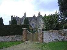
Bradley Court
Bradley is a small village in the Stroud District, in the county of Gloucestershire, England.[1] [2]
Also part of the village is the hamlet of Bradley Green. Nearby settlements include the town of Wotton-under-Edge, the villages of Kingswood and Charfield, and the hamlets Howley and Bournstream.
For transport there is the B4060 road, the B4062 road, the B4058 road and the M5 motorway nearby.
References
- ↑ Ordnance Survey: Landranger map sheet 162 Gloucester & Forest of Dean (Map). Ordnance Survey. 2011. ISBN 9780319229118.
- ↑ "Ordnance Survey: 1:50,000 Scale Gazetteer" (csv (download)). www.ordnancesurvey.co.uk. Ordnance Survey. 1 January 2016. Retrieved 30 January 2016.
Coordinates: 51°38′28″N 2°21′58″W / 51.641102°N 2.366023°W
This article is issued from Wikipedia - version of the 8/21/2016. The text is available under the Creative Commons Attribution/Share Alike but additional terms may apply for the media files.