Braffais
| Braffais | |
|---|---|
|
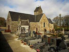
The church of Saint-Martin | |
 Braffais | |
|
Location within Normandy region  Braffais | |
| Coordinates: 48°45′28″N 1°15′36″W / 48.7578°N 1.26°WCoordinates: 48°45′28″N 1°15′36″W / 48.7578°N 1.26°W | |
| Country | France |
| Region | Normandy |
| Department | Manche |
| Arrondissement | Avranches |
| Canton | Isigny-le-Buat |
| Intercommunality | Val de Sée |
| Government | |
| • Mayor (2008–2014) | Guy de La Broise |
| Area1 | 5.79 km2 (2.24 sq mi) |
| Population (2009)2 | 185 |
| • Density | 32/km2 (83/sq mi) |
| Time zone | CET (UTC+1) |
| • Summer (DST) | CEST (UTC+2) |
| INSEE/Postal code | 50071 / 50870 |
| Elevation |
56–182 m (184–597 ft) (avg. 178 m or 584 ft) |
|
1 French Land Register data, which excludes lakes, ponds, glaciers > 1 km² (0.386 sq mi or 247 acres) and river estuaries. 2 Population without double counting: residents of multiple communes (e.g., students and military personnel) only counted once. | |
Braffais is a former commune in the Manche department in Normandy in northwestern France. On 1 January 2016, it was merged into the new commune of Le Parc.[1]
Population
| Historical population | ||
|---|---|---|
| Year | Pop. | ±% |
| 1793 | 450 | — |
| 1800 | 363 | −19.3% |
| 1806 | 486 | +33.9% |
| 1821 | 445 | −8.4% |
| 1831 | 441 | −0.9% |
| 1836 | 404 | −8.4% |
| 1841 | 397 | −1.7% |
| 1846 | 441 | +11.1% |
| 1851 | 451 | +2.3% |
| 1856 | 442 | −2.0% |
| 1861 | 441 | −0.2% |
| 1866 | 448 | +1.6% |
| 1872 | 422 | −5.8% |
| 1876 | 401 | −5.0% |
| 1881 | 362 | −9.7% |
| 1886 | 339 | −6.4% |
| 1891 | 333 | −1.8% |
| 1896 | 325 | −2.4% |
| 1901 | 340 | +4.6% |
| 1906 | 332 | −2.4% |
| 1911 | 317 | −4.5% |
| 1921 | 293 | −7.6% |
| 1926 | 279 | −4.8% |
| 1931 | 281 | +0.7% |
| 1936 | 280 | −0.4% |
| 1946 | 319 | +13.9% |
| 1954 | 287 | −10.0% |
| 1962 | 275 | −4.2% |
| 1968 | 244 | −11.3% |
| 1975 | 225 | −7.8% |
| 1982 | 212 | −5.8% |
| 1990 | 181 | −14.6% |
| 1999 | 163 | −9.9% |
| 2006 | 173 | +6.1% |
| 2009 | 185 | +6.9% |
See also
References
- ↑ Arrêté préfectoral 4 November 2015 (French)
| Wikimedia Commons has media related to Braffais. |
This article is issued from Wikipedia - version of the 8/16/2016. The text is available under the Creative Commons Attribution/Share Alike but additional terms may apply for the media files.